Helping customers gain insight into their living environment through the power of data
For more than 25 years, IMAGEM has been helping Defense, government agencies, and the GEO-ICT sector with making better, faster, and more informed decisions. Whether the focus is on security, land use planning, urban development, mobility, climate adaptation, or infrastructure, we make complex issues clear and manageable, so you can immediately see what works and where choices need to be made.
15
Years of experience and innovation in geodata
26
Passionate geo specialists
300
Projects completed and under management
The driving force behind IMAGEM
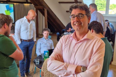
Behind every innovative solution from IMAGEM there is a team of passionate geodata specialists, consultants, and developers. With in-depth knowledge of both technology and societal domains, they work every day to shape the digital future. They are not only experts in their field, but also dedicated partners who believe in the power of collaboration to solve the biggest challenges.
Complex issues require a comprehensive approach that integrates knowledge, data, and technology
At IMAGEM, we don’t start with systems or data, we start with the question behind the question. Together, we make sense of complex environments by connecting domain expertise, data, and technology. This allows you to automate what can be automated and create space for better analysis and decision-making, always based on a single, shared, and reliable view. Curious to learn how we do that?
Grown from a modest startup into a leader in geospatial technology
Founded
IMAGEM started in 2009 as a company specializing in geospatial solutions. That same year, it became the official distributor of ERDAS for the Benelux region. Thanks to this partnership, IMAGEM was able to offer high-quality remote sensing and image analysis products to customers in the Netherlands, Belgium, and Luxembourg.
By offering innovative software solutions for image processing, geoinformation, and spatial analysis, IMAGEM established itself as a leader in the regional GIS market, with ERDAS as a reliable partner for technological support and development.

Hexagon
In 2014, IMAGEM took a significant step by becoming the official distributor of Hexagon in the Benelux region, after Hexagon had acquired ERDAS in 2011 and integration it into Hexagon’s geospatial division. For IMAGEM, this transition meant an expansion and deepening of its product portfolio. Including the addition of ERDAS Imagine, but also products such as GeoMedia, ERDAS APOLLO, and the software platform for web-based GIS solutions. Thanks to Hexagon's powerful combination of remote sensing, photogrammetry, and advanced GIS technologies, IMAGEM could offer their customers even more comprehensive and integrated solutions, ranging from data acquisition and analysis to the visualization and distribution of geographic information.

Award
In 2015, IMAGEM was rewarded with the prestigious Hexagon Strategic Investment Award, in recognition of its commitment and strategic investments for strengthening and expanding Hexagon technologies within the Benelux market. This award highlighted IMAGEM's active role as an innovative partner and underscored its ability to identify new opportunities and successfully translate them into concrete solutions for its customers. The award also confirmed the strong and fruitful collaboration between IMAGEM and Hexagon Geospatial, and spurred further growth and development of advanced, integrated geospatial applications within the region.
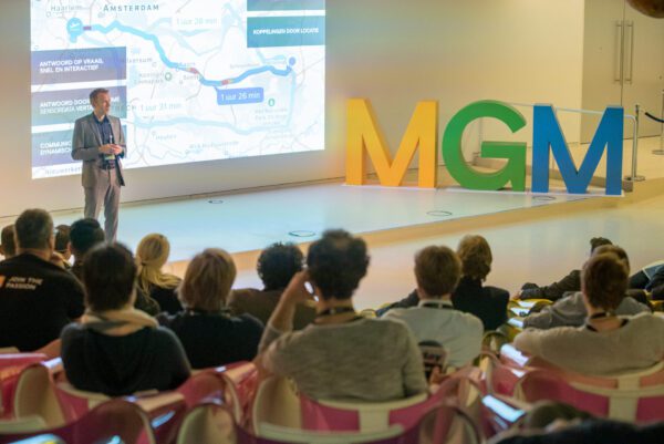
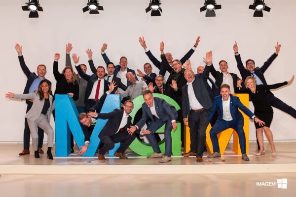
Make Geospatial Matter
In 2017, IMAGEM organized its IMAGEM annual customer event under the name “Make Geospatial Matter.” This inaugural edition took place at the inspiring Media Plaza of the Jaarbeurs in Utrecht and brought together professionals, partners, and customers from across the Benelux region to explore the latest developments and applications in the geospatial field. During the event, innovative customer case studies were presented, complemented by interactive workshops and demonstrations of Hexagon Geospatial technology. Since then, Make Geospatial Matter has grown into an important annual gathering for knowledge sharing and networking within the geospatial community, where IMAGEM has been able to further strengthen IMAGEM leading role as a strategic partner of Hexagon Geospatial.
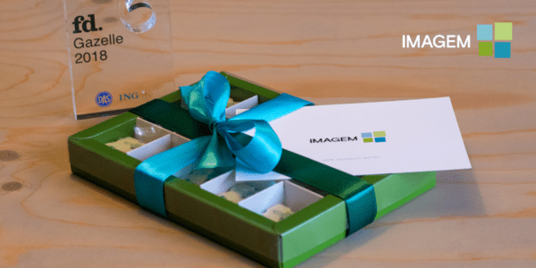
FD Gazellen
In 2018, IMAGEM received another major accolade when IMAGEM was honored with the FD Gazellen Award, a prestigious prize presented by the Financieële Dagblad to the fastest-growing companies in the Netherlands. This award highlighted not only IMAGEM impressive growth performance, but also its sound business practices, financial health, and ability to deliver sustainable results.
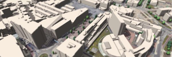
Digital Twin
Luciad, a provider of geospatial situational awareness technology used worldwide in mission-critical applications, announced its acquisition by Hexagon AB in 2017. Within two years, IMAGEM had integrated the Luciad portfolio within its offering and was actively promoting 3D applications in geospatial-related fields. Luciad applications allowed developers and end users to utilize advanced visual analytics that enable them to harness the full potential of real-time location intelligence, thereby laying the foundation for the next generation of geospatial systems.
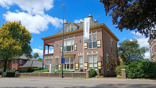
Relocation
In line with its continued growth and ambitions, IMAGEM moved in 2019 to the “Von Zeppelin” office villa, a historic building located in the center of Apeldoorn. This move marked an important milestone and provided IMAGEM only with an inspiring, prestigious work environment, but also with more space to support its continued development. From this distinctive location, IMAGEM was able to better host its clients and partners and further optimize collaboration both internally and externally.
Milestone
In 2020, IMAGEM continued its growth and reached the milestone of 20 employees, significantly expanding the team with specialists in geospatial technology, data visualization, and software development. This year was also marked by innovation with the launch of DELTA, a proprietary change detection solution based on artificial intelligence and advanced remote sensing. With DELTA, customers could automatically and accurately detect, monitor, and analyze changes in the landscape and the built environment.

Oneport
In 2021, IMAGEM further expanded its product portfolio with the introduction of Oneport, an advanced ordering system for ERDAS APOLLO. ERDAS APOLLO is a comprehensive data management and distribution server solution that helps organizations identify, secure, and organize geospatial and business data in a searchable repository. Oneport was developed to streamline the ordering process for this powerful software, making it easier for customers in the Benelux region to access ERDAS APOLLO and its associated services.

Planspace
Since 2023, Planspace has been developed with the aim of significantly simplifying and accelerating policy processes and the discussion of spatial plans and projects. Planspace is an accessible, web-based environment based on LuciadRIA in which users can easily visualize knowledge without any programming requirements and combine spatial data quickly in both 2D and 3D.
Thanks to a wide range of features based on Luciad —such as shadow analysis, line-of-sight visualization, interactive placement, and content-based assessment of 3D objects—decision-makers, planners, and other stakeholders can clearly simulate and communicate the impact of proposed developments. In this way, Planspace contributes to more efficient decision-making, better collaboration, and a more transparent process surrounding changes in the physical environment.
Proud of these partnerships
We help customers gain insights into their living environment by harnessing the power of data.