Want to get started with a digital twin but don’t know where to begin? At IMAGEM we make it easy. With our expertise, approach, and innovative technology, we guide you step by step through the process of setting up a digital twin, supporting you in taking the first steps, making the right choices, and sustainably implementing the digital twin your organization. This quickly and effectively turns it into a powerful tool for solving complex issues in the physical environment.
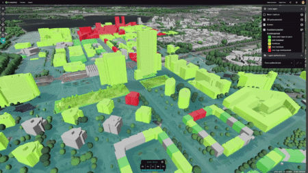
You’ll develop a digital twin that goes beyond just the creation of a simple virtual model and stakeholder engagement. You’ll have an environment where you can integrate 2D and 3D data, BIM/Revit models, and other sources; simulate scenarios; test new plans; and immediately see the effects of policies. This allows you to make data-driven decisions faster, reduce failure costs, and collaborate more efficiently.
Simulate, visualize, and share; fast and accessible to everyone
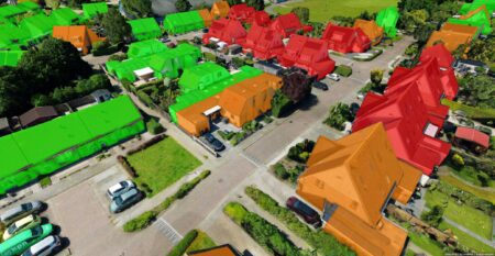
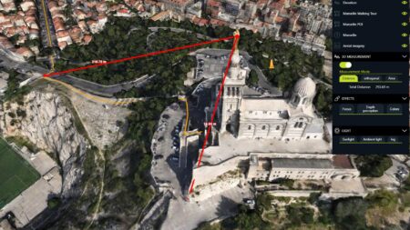
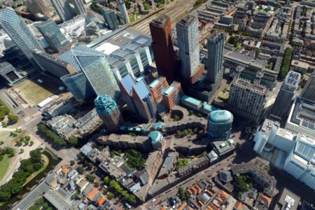
The digital twin created by IMAGEM supports complex decision-making. Whether you’re working on construction projects or urban development challenges, our digital twin lets you effortlessly visualize, simulate, and share information. View construction plans in realistic 3D, predict flooding caused by climate change, and engage stakeholders and residents through intuitive, shareable data.
Our solution is open-source, based on Common Ground principles, and designed with a focus on ease of use. This means that both those who create and implement digital twins, and the policymakers who use them to address their challenges can see immediate results. Whether you’re working with detailed 3D models for internal projects or sharing them with external parties, the digital twin from IMAGEM offers a clear, fast, and accessible representation of your living environment.
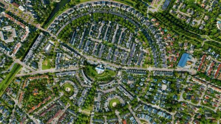
What can you use a Digital Twin for?
With an IMAGEM digital twin you build a virtual, reliable, and up-to-date replica of your municipality. Think of it like a kind of testing ground where you can test, refine, and adapt key issues related to your physical environment. For example:
Climate adaptation
Simulate the impact of climate change and plan adaptations, such as greener cities and water management.
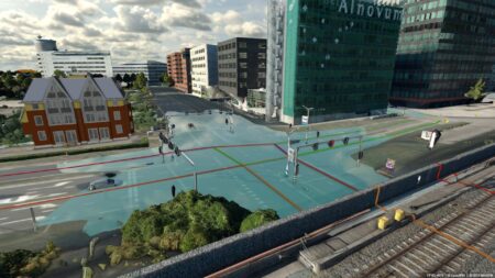
Scenario simulation
Test and visualize various urban development plans, such as new infrastructure or housing projects.
Environmental Monitoring
Track air quality, noise pollution, and other environmental indicators to develop better policies.
Housing Construction
Analyze and plan new residential areas, taking into account demographic trends and infrastructure needs.
Energy savings
Optimize energy consumption in buildings and neighborhoods by identifying opportunities for savings.
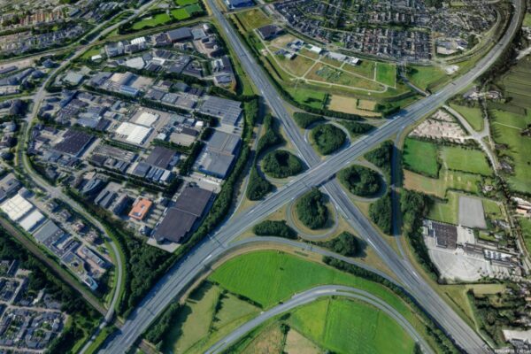
Infrastructure Management
Plan the maintenance and management of roads, bridges, and sewer systems based on real-time data.
The Power of a Digital Twin Practice
A digital twin plays a crucial role in improving decision-making and offers cities significant benefits when fully implemented. In addition to custom solutions, there are numerous off-the-shelf applications available.
Frequently Asked Questions
-
Thanks to the technology of Octave Alto Server (Formerly known as Luciad Fusion), we eliminate the complexity of working with 2D and 3D data components in a viewer:
- You can set up a digital twin less than a minute.
- The technology is user-friendly, open, flexible, agile, and easy to integrate into any architecture through APIs with domain specialists.
- You work collaboratively, communicating information to all parties in a simple, clear, and straightforward manner, which in turn contributes to greater citizen participation.
- IMAGEM knowledge-intensive processes.
- With our Planspace approach, we are currently in phase 4 of the maturity model of United Dutch Municipalities (VNG).
-
No, that’s not necessary. Data is rarely complete or perfectly organized. What’s more important is to decide which question you want to start with and what data you need to answer it. A digital twin develops step by step: you expand its applications and add more data as you go. It’s easy to add or adjust data later on. Simply put, just get started, and keep building as your problem evolves.
-
This is a common challenge. Many initiatives start out with great enthusiasm but end up as one-off projects. To prevent this, IMAGEM has developed an approach focused on sustainable implementation.
A digital twin is not an end goal by itself, but an ongoing process. Successful implementation requires active involvement from various stakeholders, including the business. This increases the likelihood of widespread adoption and ensures greater buy-in for the investment in technology and budget.
That is why we not only support organizations technically, but also through the process of change itself. Through workshops, we foster collaboration, alignment, and joint decision-making regarding applications and priorities. In this way, adoption grows step by step alongside the organization.
-
In our digital twin environment, you can easily access and use various types of data directly from the source. This aligns with our vision of working as openly as possible, inspired by the Common Ground concept. Our Octave Alto (formerly known as Luciad) plays a key role in this.
For example, you can import large data files -such as BIM models- directly and without losing any attribute data. Thanks to a tool we developed, this can be done without complex programming, without cumbersome conversions, and without any loss of quality.
Our goal is to make complex issues simple and practical. The way we handle data in digital twins are a great example of this.
Learn more about Digital Twin
Easily convert raw data into OGC 3D Tiles
Converting various types of data into OGC 3D Tiles may sound complicated, but it doesn’t have to be. Whether you’re working with LIDAR, photogrammetry, CAD/BIM, GIS data, mesh models, reality capture, sensor data, OBJ, or glTF files, IMAGEM Simulator IMAGEM Simulator complexity out of the process.
Get started with 3D and digital twin effortlessly and without any hassle
At IMAGEM , we IMAGEM setting up a digital twin and accessible. Whether it involves scenario analyses, subsurface mapping, or issues related to mobility, housing development, or noise modeling, IMAGEM digital twin IMAGEM you get started right away.
Accelerate with the IMAGEM Digital Twin
Do you want to see firsthand how a digital twin works digital twin practice and get started right away with your own data? Discover the IMAGEM Digital Twin : a co-creation platform where you can learn, experiment, and share knowledge alongside other organizations.
Knowledge Report: Digital Twin Cities
Geospatial World, commissioned by our partner Hexagon, has researched why Digital Twins are essential for cities. This technology plays a crucial role in improving decision-making and will offer cities significant benefits when implemented. Although Digital Twins are gaining popularity in many various sectors, their potential for cities is especially significant. Download the report and discover how digital twins can make a difference for your municipality.
IMAGEM Digital Twin
Do you have any questions or would you like to speak with one of our experts? Feel free to call or contact us.
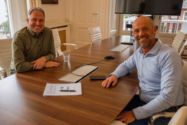
Niels van de Graaf
Government Market Manager

Stefan Lijst
Business Consultant
Do you have any questions or simply want to get started with a Digital Twin?
With our knowledge, experience, and approach, we’d be happy to help you start creating and develop a digital twin that goes beyond a virtual model. Ready to get started? Give us a call or leave your contact information, and we’ll get in touch.