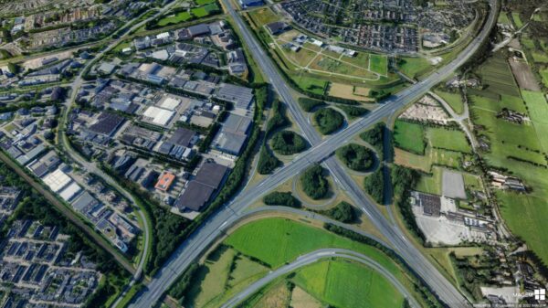

Policy-making involves making decisions based on a large volume of diverse data. This data comes from various sources, is often inconsistent, and takes a significant amount of time to make usable. As a result, it is difficult to make quick and well-informed decisions about major challenges in the physical environment—such as housing, climate adaptation, mobility, and the energy transition—and to secure the support of all stakeholders.
Digital twins help with this, but they are not yet widely used because they require both technical and domain-specific knowledge. After all, converting, managing, and making data available requires a great deal of expertise and time. IMAGEM technology, expertise, and a practical approach, making digital twins accessible and effective to use.
Why it's often difficult to get started with a digital twin
The Ministry of the Interior and Kingdom Relations, Geonovum, Dutch Metropolitan Innovations (DMI), T3D, the Association of Netherlands Municipalities (VNG), and the European Union are all digital twins promoting the use of digital twins . The benefits are clear: faster insights, integration of information from different domains, and a lower risk of errors and high costs. Yet taking that first step often proves difficult. Perhaps you recognize that there is little time within your organization or that support needs to be built up. But the biggest hurdle is often data usage: how do you make diverse data sources accessible and usable in a digital twin?

From complex technology to practical application
The technology for digital twins already exists, but it is often complicated to use. The problem usually lies not in the visualization, but in accessing and integrating the data.
IMAGEM with users to investigate what really works in practice, with a focus on user-friendliness, an open system, and the common ground principles. The result is Planspace Simulator, based on Luciad that has been continuously developed for over 25 years. We use LuciadFusion for data management and access, and Simulator for visualization.
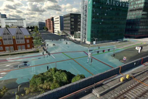
With this combination, you can easily bring together a wide range of data sources—from terrain models and point clouds to 3D models and traditional 2D maps—into a single digital environment. Because we offer this via the cloud, it has no impact on your organization’s own resources and infrastructure. This creates a digital twin is technically robust yet intuitive and accessible, allowing you as a user to get started right away.
One environment where you're in control
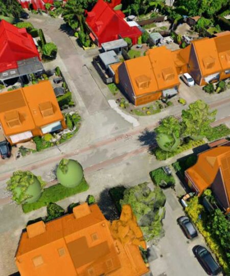
With LuciadFusion, you can quickly and easily convert, catalog, and manage all kinds of data—from terrain models, point clouds, reality meshes, panoramas, and 3D models (glTF, OBJ, IFC, etc.) to, of course, all standard 2D data (both raster and vector data). In the Planspace Simulator , youSimulator then visualize this data in a single, clear digital environment and easily share the results with colleagues or external stakeholders.
The technology simplifies complex processes such as data conversion and configuration, allowing you to manage and utilize data efficiently and with peace of mind. IMAGEM also IMAGEM consulting and support during implementation, enabling you to work successfully and effectively with digital twins.
You can get started on your own without any programming knowledge and won’t have to rely on outside specialists. This allows you to maintain control and oversight of your own data, which you can use specifically to address the challenges you’re facing. This makes the technology accessible to a wide range of users within your organization and ensures that everyone can work with the same up-to-date and reliable data.

Easily visualize data from the library
Using the library in the Simulator, you can easily integrate both your own data and external datasets—such as PDOK, Atlas Leefomgeving, BRO, Cyclomedia, Google, and OpenStreetMap—into your visualizations. This library offers a wide range of datasets that you can select and combine, giving you a comprehensive and detailed view of your project.
The value added by this library is enormous:
- Data Conversion: The library takes the complexity of data conversion off your hands. Whether you’re working with terrain models, point clouds, reality meshes, panoramas, 3D models, or traditional 2D data, Luciad automatically converts various data formats into open-standard OGC web services.
- Time-consuming processes: The library’s intuitive interface allows you to quickly catalog and filter datasets. This saves you the hours normally spent manually managing and integrating data. You can be done in just a few minutes, saving you a significant amount of time.
- For everyone to use: Using the library makes it easier to select and combine many different types of data. The user-friendly tools allow you to create comprehensive and complex visualizations even without technical expertise. This makes the technology accessible to a wider range of users within your organization.
- Complex configurations: The library is designed to simplify configuration processes. You don’t have to worry about complex settings; the technology is user-friendly and ensures seamless integration of various data sources and formats. This allows you to focus on what really matters: analyzing and utilizing your data.
With LuciadFusion and Planspace Simulator , IMAGEM Simulator IMAGEM robust and user-friendly solution that digital twins you digital twins the full potential of digital twins and manage and apply data with confidence and ease. This helps you make better-informed decisions and reduce operational costs.
Concrete benefits for policy and implementation
Thanks to IMAGEM technology, the technical barrier to creating a digital twin IMAGEM digital twin lowered. Data specialists can build a twin more quickly, while policymakers and decision-makers can use the results immediately without having to deal with the technical aspects. The result: faster insight into scenarios and consequences, greater stakeholder engagement, and more efficient processes. With LuciadFusion and Planspace Simulator , youSimulator put digital twins to digital twins use in your organization. Our years of experience with geoinformation and data integration enable us to make complex data accessible, usable, and relevant to your challenges.
More information
Niels is the Government Market Manager at IMAGEM. He helps government agencies continuously work smarter and more effectively, and fulfills his role by supporting organizations in solving their challenges. Want to learn more? Send Niels an email or send a message via our contact form.

Niels van de Graaf
Government Market Manager