The question isn't whether risks will arise, but whether you can spot them in time
Safety is under increasing pressure. Climate change is leading to more extreme weather, infrastructure is aging, and pressure on public spaces is mounting. At the same time, the volume of data is growing, but there is often a lack of an overview needed to identify and properly assess risks in a timely manner.
Many safety issues only become apparent once their impact is already being felt. Whether it involves flooding, land subsidence, unstable infrastructure, or risks in public spaces, without up-to-date and comprehensive insights, it remains difficult to make the right decisions.
Better insight starts with the early detection of changes in the environment. remote sensing these changes visible sooner, enabling organizations to better assess the situation and take faster, more targeted action.

Land subsidence occurs gradually, but often only becomes apparent when sudden damage or danger occurs.
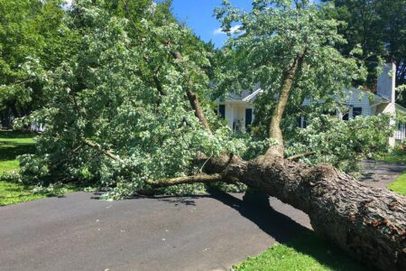
During storms in the Netherlands, such as Storm Poly (2023), fallen trees often turn out to have been weakened—without this being apparent beforehand.
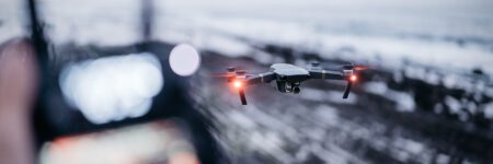
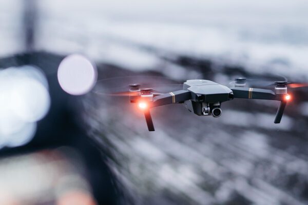
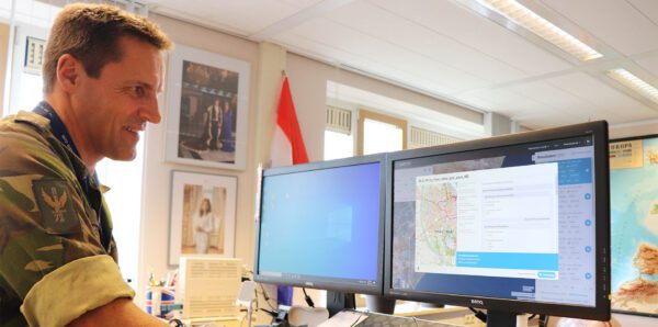
In the event of major fires, accidents, and search operations, Dutch emergency services are increasingly using drones to obtain a real-time overview.
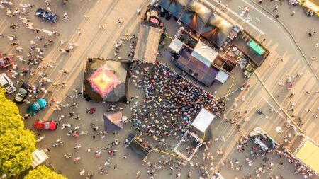
Crowd management is more relevant than ever due to the growing scale and complexity of events.
The Netherlands is vulnerable to flooding, and rising sea levels are increasing that risk even further.
Safety starts with understanding
From wildfires and floods to risks right on your own street: safety requires a clear overview, good timing, and the right information. remote sensing changes in the environment visible sooner, enabling organizations to better assess the situation and act more quickly.
But what is safety?
Safety is about protecting people, their living environment, and everything that matters within it. This starts on a global scale, with major events such as wildfires, floods, droughts, wars, and large-scale population displacements. But safety is just as relevant closer to home. Think of an unstable levee, water on the streets after extreme rainfall, crumbling infrastructure, or a tree along the road that poses a risk to passersby.
To effectively manage these types of risks, insight is needed—not just in hindsight, but in real time. This is where remote sensing comes remote sensing play: the observation of areas from a distance using satellites, aircraft, and drones. This makes changes, risks, and threats visible at an early stage, enabling governments and organizations to respond more effectively.
Observing from a distance
Remote sensing us better understand safety, identify risks earlier, and act more quickly when necessary. From flooding and dike monitoring to traffic safety, live incident management, and privacy-friendly monitoring: spatial insights are playing a role in more and more areas. As a result, safety is increasingly shifting from reacting after the fact to timely detection and targeted action. And that applies at all scales: from global crises to safety in your own street or neighborhood.
Water Safety and Flooding
Water has been a major safety concern in the Netherlands for centuries. Heavy rainfall, prolonged wet spells, and rising sea levels are putting increasing pressure on dikes, flood barriers, and water management systems. This has direct consequences for homes, roads, infrastructure, and ultimately for people’s safety.
Using remote sensing , we systematically remote sensing large areas. Satellites reveal where water accumulates, how wet an area is, and where changes are occurring in the landscape. This helps identify emerging risks more quickly and supports better decisions in water management and land-use planning. In this way, safety becomes not just a matter of reacting, but also of looking ahead.

Dikes, subsidence, and slow-onset risks
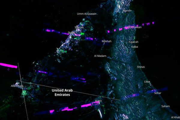
Not every safety risk is immediately apparent. Some threats develop gradually—such as land subsidence, ground deformation, and minor subsidence in dikes, roads, or bridges. And this can have major consequences over time. Using satellite technologies like InSAR, we monitor these types of movements with great precision.
InSAR (Interferometric Synthetic Aperture Radar) is a satellite-based radar technique that measures ground displacement and structural deformation with millimeter precision. By comparing radar images taken at different times, InSAR makes it possible to monitor, among other things, subsidence, earthquakes, and the stability of infrastructure over the long term. As a result, small changes are detected earlier, often before they develop into a larger problem.
This is evident, for example, in the example shown here on the land subsidence map of the Netherlands, which clearly illustrates where the ground is shifting the most and how gas extraction in Groningen is causing land subsidence (source).
This gives property managers greater control over maintenance and scheduling, and allows risks to be identified and addressed sooner for residents.
Safety in everyday traffic
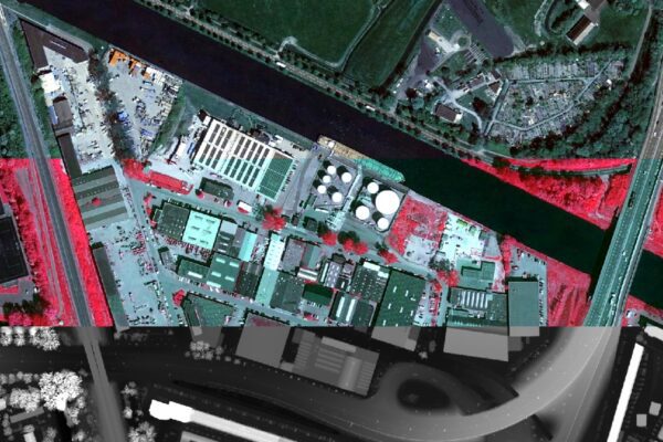
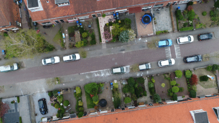
Safety isn’t just about major disasters or critical infrastructure. Spatial risks also play a role in everyday life. For example, trees along roads can become unstable due to disease, root problems, or uneven growth. This can pose a danger to drivers, cyclists, and pedestrians. Aerial photos, drone imagery, and satellite data help detect these kinds of issues earlier. This makes it possible to efficiently monitor larger areas and take targeted action where necessary. That makes inspections safer and helps better manage risks in public spaces.
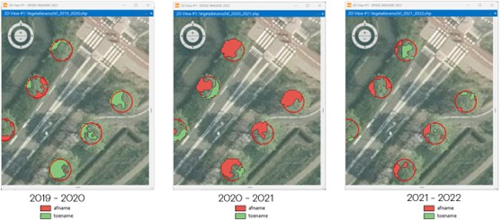
For example, by using the NDVI (Normalized Difference Vegetation Index), a vegetation index that uses satellite imagery to provide insight into the vitality and health of trees. By comparing NDVI values over several years, changes in foliage and growth become apparent.
In this analysis, red and green zones indicate a decline and an increase in vegetation vitality, respectively. In this way, multi-year NDVI monitoring makes it possible to identify high-risk trees in a timely manner and implement targeted management measures.
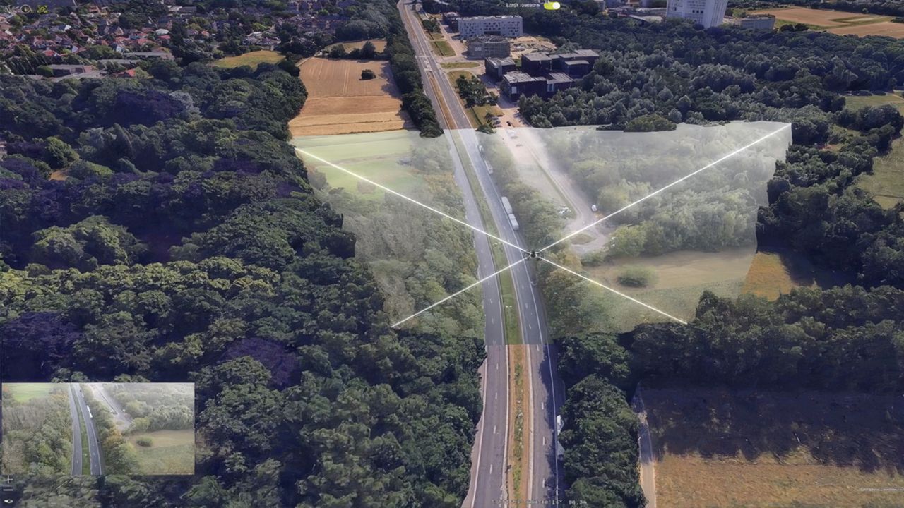
Real-time visibility during incidents
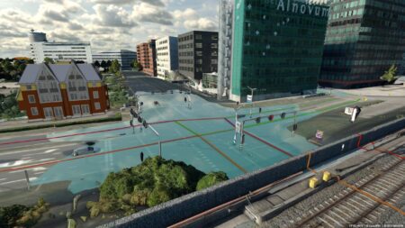
Safety isn’t just about proactive monitoring; it’s also about having a real-time overview. During events, traffic incidents, or emergencies, it’s crucial to quickly know what’s happening and where it’s taking place. By linking live drone footage to maps and 3D environments, a real-time picture of an area is created. In a digital twin, information converges within a single spatial context. This helps operators, emergency services, and safety organizations assess situations more quickly and take more targeted action. Live imagery thus becomes more than just video: it becomes actionable information for decision-making.
Security and privacy considered together
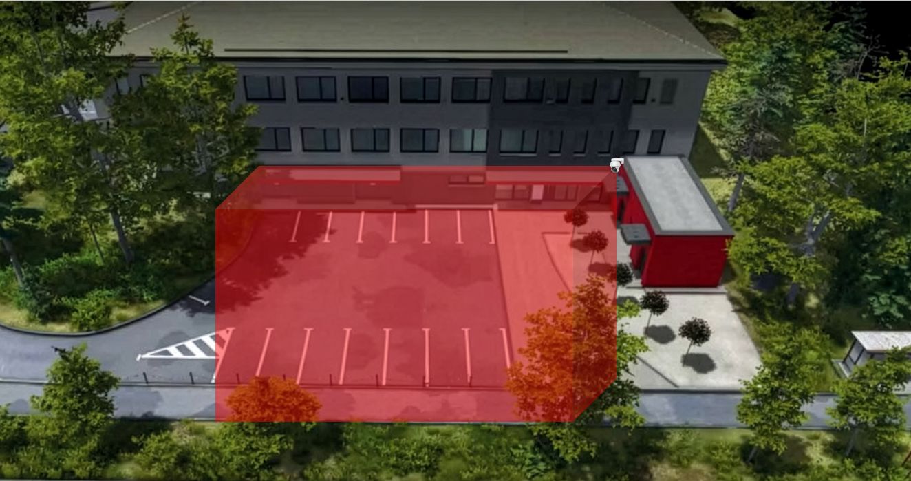
Privacy plays a key role in modern security solutions. Traditional cameras often capture recognizable individuals, raising questions about data protection and legislation. That is why solutions are emerging that record movements and patterns without capturing identities. Consider LiDAR-based systems that track people and vehicles as 3D objects without storing facial images. This creates a form of monitoring that is suitable for public spaces and critical infrastructure, while better safeguarding privacy. Security and privacy do not have to be mutually exclusive. This, too, is remote sensing—it remains the remote observation of objects using a sensor.
IMAGEM Security Through Data and Insights
IMAGEM governments and organizations address safety issues proactively and with a solid foundation. Using advanced technologies such as remote sensing digital twins , we continuously digital twins risks, patterns, and trends. This creates an up-to-date and comprehensive overview of the living environment, enabling you to identify issues faster, make more accurate predictions, and take more effective action. As a result, safety is not only managed reactively but organized in a data-driven and future-oriented manner.
Safety in Practice
Let’s work together on safety?
Every security challenge is unique and requires an approach tailored to the specific situation. We’d be happy to work with you to explore how data and technology can help you gain better control over security. Feel free to contact us.

Harald Görtz
Business Consultant