Would you like to hear our take on current topics, learn about interesting ideas, and more?
Then follow our updates by subscribing to our newsletter.
Articles and updates
Filter options
Use the buttons to filter the list of results. The list is updated automatically.
From drone data to actionable 3D insights
Fast and reliable information makes all the difference when it counts. Yet in practice, drone data often remains scattered across individual images, separate software steps, and fragmented workflows. IMAGEM and Skyline are changing that. Through an equal partnership, we combine data collection, 3D processing, centralized data management, and visualization into a single integrated workflow.
A digital twin for all
Policy-making is a complex process due to fragmented data and time-consuming procedures. Digital twins a solution, but require specialized knowledge and technical expertise. IMAGEM technology, expertise, and a practical approach, making digital twins accessible and immediately usable for municipalities.
Two people celebrating anniversaries, one story
This year, two colleagues are celebrating special anniversaries at IMAGEM: Niels van de Graaf, Government Market Manager, has been with us for 10 years, and Syreetha Nuhuway, Operations Specialist and jack-of-all-trades, has been with the company for 5 years. This is a great opportunity to reflect on their work, their growth, and, above all, the people behind these roles.
From Games to the Globe: How 3D Engines Are Conquering the World
3D technology is now being used for real-world applications: from smart cities to air traffic control. But how can an engine that was once designed to bring virtual worlds to life suddenly become crucial for large-scale geospatial projects? In this article, we explore the striking differences between geo-engines and game engines. Because when it comes to accuracy, scale, and reliability, a geo-engine like Luciad turns out to operate Luciad a completely different league.
Harald & Tjip and How AI remote sensing Support remote sensing (E12)
In the latest episode of the Geospeciale Podcast, Harald Gortz and Tjip van Dale discuss the rise of Agentic AI in remote sensing. Using relatable real-world examples—from timber deliveries to manure silos and waterways—they demonstrate how AI systems are becoming increasingly autonomous.
Niels & Stefan on digital twins Practice (E11)
In the Geospecial podcast "To digital twin Not to digital twin ," Niels and Stefan digital twin what they encounter in practice. They explain how municipalities and government agencies are increasingly discovering how 3D models help not only to visualize plans but also to immediately assess them against policies, standards, and objectives. They also share current examples, insights, and technological developments related to digital twins.
Remote sensing 4: First Observe, Then Visualize in Ezinge
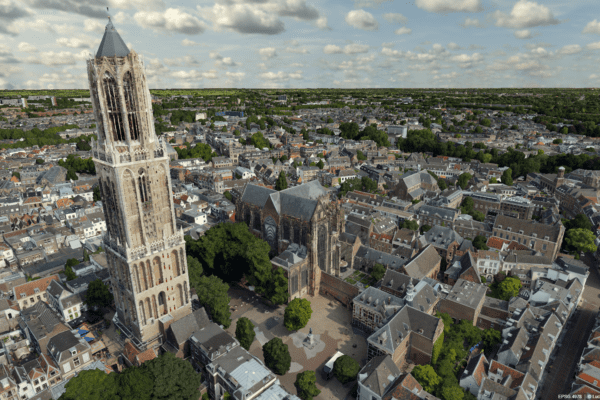
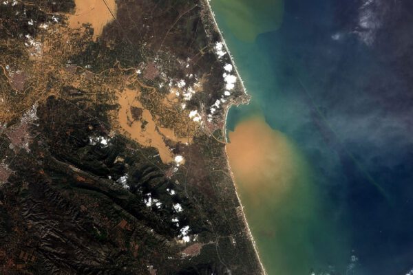
Before we can visualize anything in a digital twin, we first need to understand what we’re actually looking at. Without that foundation, visualizations are nothing more than pretty pictures. In part four of the series, Harald takes a step back to the beginning: observation itself. Not just via satellites or drones, but also with our own eyes. Remote sensing with observation—knowing who is looking, why, and with what instrument. Only then can you combine data into information that is accurate, meaningful, and usable.
Mapping mudflows using a single satellite image
Severe mudslides struck the Valencia region. But how do you analyze a disaster area like this if you don’t have pre-flood imagery? Read how we developed a smart and fast analysis method using satellite data, the Flood Mud Index (FMI), and advanced image processing in ERDAS .
Harald and Tjip: How remote sensing Is Accelerating remote sensing Water Authority's remote sensing (Podcast E09)
Remote sensing finally come of age in Dutch water management. Harald and Tjip argue that everything hinges on who is observing, with what tools, from what altitude, and—above all—for what purpose. All these different methods of observation overlap like layers of transparencies; only when you combine them does a coherent picture emerge that water authority staff can immediately translate into policy and action. Discover step by step how you can apply the same techniques from this podcast in your organization, and let Harald and Tjip guide you on how to accelerate your processes.
Meet our new CEO: An in-depth interview with Eric-Jan van Alten
Founder Wouter Brokx has handed IMAGEM the day-to-day management of IMAGEM to Eric-Jan van Alten. Eric-Jan has now taken on the role of CEO and has gained his first impressions. With over fifteen years of experience in scaling organizations and products, he brings new energy and a fresh perspective. But who is he, really? What drives him? And how does he view the future of IMAGEM?