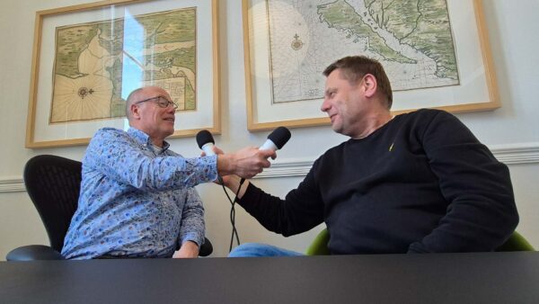

Remote sensing—collecting data without physically being in the field—has been a familiar concept in Earth observation for years. But thanks to razor-sharp satellite imagery, affordable drones, and machine-learning algorithms, it has now become a fully-fledged tool in Dutch water management. In the latest podcast, Harald and Tjip explain how this technology is transforming the centuries-old inspection process into a streamlined, data-driven workflow with 80% fewer field inspections.
Listen to the podcast
Remote sensing come of age
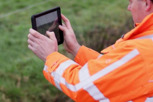
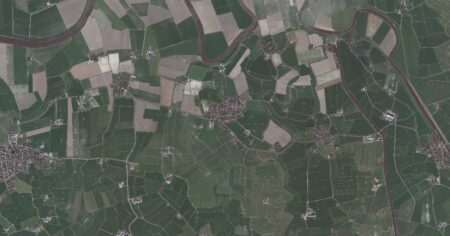
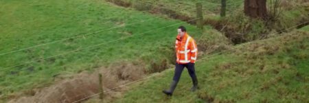
Whereas surveyors used to trudge along thousands of ditches in rubber boots, armed with paper maps and plenty of patience, the process now increasingly begins behind a computer screen. Remote sensing come of age.
In the podcast, Harald and Tjip explain how smart sensors, satellites, and algorithms are working together to modernize the age-old art of fire assessment. Not to replace people, but to act as a catalyst: it saves time, money, and CO2, while also improving the quality of decisions.
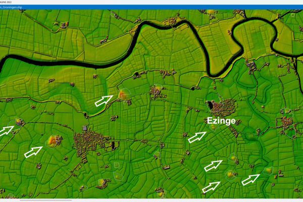
Four Ways of Seeing: From Human to Satellite
By cleverly layering these data sets, you create a narrative, and that is precisely what makes remote sensing powerful for land management. Harald and Tjip explain that each “perspective” has its own scale and added value:
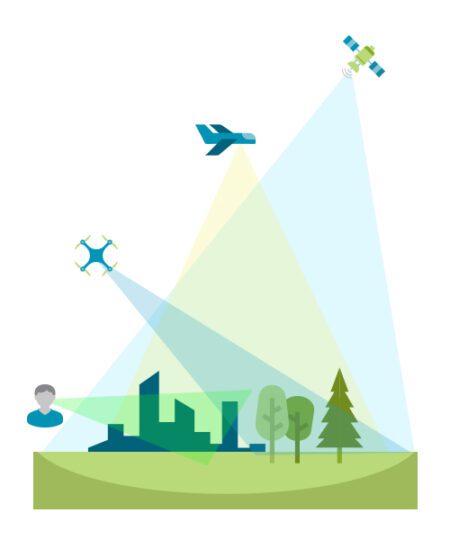
| Level | Technology | What you see | What it excels at |
|---|---|---|---|
| Human | Keep your eyes on the ground | Detail & nuance | Context, policy review |
| Drone | RGB/NDVI cameras | Daily changes | Quick close-up |
| Airplane | Aerial photos/LiDAR | Regional overview | Patterns & Trends |
| Satellite | Multispectral & radar | Time series, entire region | Objectivity & scale |
From eye level to satellite view: seeing with context
"It all starts with looking," say Harald and Tjip. "But who is looking, from where, and for what purpose? A person sees details up close but lacks the big picture. Drones fill that gap with daily images that reveal subtle changes. Airplanes map entire regions." Satellites add the long-term perspective: they show growth patterns of villages, silting-up ditches, and the traces of drought or precipitation. Combine all those perspectives and you get a complete picture—exactly what you need to make good decisions.
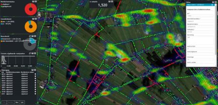
A striking example comes from the Drents Overijsselse Delta Water Board (WDO Delta), where Tjip was closely involved. For years, the annual inspection process there involved sixty people spending weeks in the field. Today, the workday begins with coffee and a satellite image, which uses smart observations to pre-assess which ditches are likely to be clean, questionable, or overgrown. The “ground truth” provided by experienced inspectors continuously feeds the algorithm, making the digital inspection increasingly smarter. Not a black box, but a collaboration between humans and machines.
Effects of screen time
The results are striking. About three-quarters of all waterways receive digital approval. Only the borderline cases still require a drone flight or a brief field inspection, depending on the location or the degree of uncertainty. This means fewer miles traveled, less workload, and, conversely, more focus on risk management, reporting, and prevention—areas that previously ended up at the bottom of the list.
Dealing with "probably clean" in a smart way
But there’s also a pitfall, Harald and Tjip point out. Because if an algorithm says something is “likely clean,” what do you do? Do you still check everything? Or do you dare to trust the data? The key lies in smart risk management: determine in advance what level of certainty you need, and clearly define responsibilities. At WDO Delta, the optimistic approach has proven to be the most effective, provided you agree on clear rules.

The expert remains indispensable
Technology records, but it does not understand. A satellite detects an anomaly, but only an expert can determine whether it is dredged material, reeds, storm damage, or an illegal dam. Policy context also plays a role: what is ecologically desirable in one area may actually pose a problem elsewhere. That is precisely why the specialist remains indispensable, with remote sensing a powerful tool at their disposal.
Want to know more? Listen to the full podcast
Are you curious about the details of the algorithm they’re discussing in the podcast? Do you want to know how the combination of RGB and infrared bands interprets the depth of a ditch, why LiDAR is sometimes unsuitable for large areas, or how you can see both vegetation status and ground elevation in a satellite image?
Listen to the episode “Harald and Tjip: How remote sensing Water Authority’s remote sensing ” and discover, step by step, how you can apply the same techniques in your organization.

Harald Görtz
Business Consultant
Tjip van Dale
Business Consultant