Harald Gortz is a Business Consultant at IMAGEM works at the intersection of technology and visualization. He uses sensor data, satellite imagery, radar techniques, and geospatial data to uncover patterns that would otherwise remain hidden. His work at IMAGEM around translating complex datasets into insights that inspire, activate, and provide direction. Whether it’s a flooded landscape, an analysis of green roofs, or a historical reconstruction, Harald demonstrates how data can tell a story. He remote sensing thinks remote sensing is cool—because it’s technology that reveals what would otherwise remain hidden, and because he literally takes to the skies with it himself. As a certified drone pilot. He shares his findings in blogs, visuals, and projects that bring geo-technology to life.
In his free time, he loves to cook for family and friends, enjoys spending time outdoors, takes photos, and stays active through sports.
Data doesn't lie; it's up to us to understand it and translate it into insights that matter.
— Harald Görtz, Business Consultant
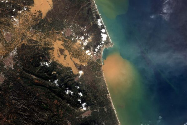
Harald is involved in projects where geospatial information plays a crucial role, ranging from security solutions to digital twins climate adaptation. In his blogs and analyses, he demonstrates how observation—whether via satellites, aerial photographs, sensors, or simply with the naked eye—forms the basis for reliable data interpretation and visualization.
With his passion for geodata, remote sensing, multispectral data, LiDAR, and radar, he uses technology to truly get to the bottom of social and operational challenges. His strength lies in making connections: between business and technology, between customer needs and data capabilities, and between raw data and clear decision-making.
Area of expertise
- Geography & remote sensing
- Data-Driven Work & Visualization
What can Harald help you with?
- Advice on the use of geospatial, sensor, and remote sensing : for when you want to use satellite data, aerial photographs, or elevation maps for analysis, monitoring, or decision-making.
- Development of geospatial solutions and data workflows: these include digital twins, climate analyses, water management, and the creation of risk maps.
- Interpretation and analysis of complex datasets: translating "raw data" into meaningful insights.
- Business consulting in the field of geotechnology: bridging the gap between client goals, technology, and practical implementation.
- Presentations, blogs, and knowledge sharing on topics such as remote sensing, geovisualization, climate adaptation, historical geo-reconstructions, and societal applications of geodata.
Would you like to speak with Harald?
Would you like to know more or do you have any questions? Send Harald a message—he’d be happy to help.