
As Helmut Kohl once said: “If you don’t know the past, you cannot understand the present or shape the future.” This certainly applies to our climate challenges as well. With Remote Sensing geographic data, we can not only look back but also map current problems such as flooding and heat stress. By combining this historical and current data, we can even make targeted predictions and work on sustainable solutions for the future.
Exploring the Past with Remote Sensing
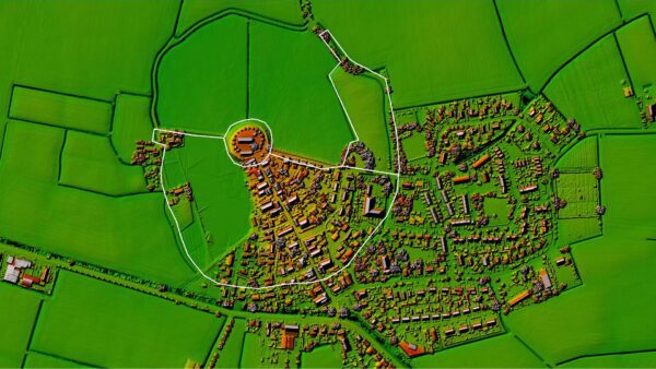
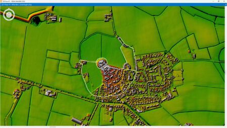
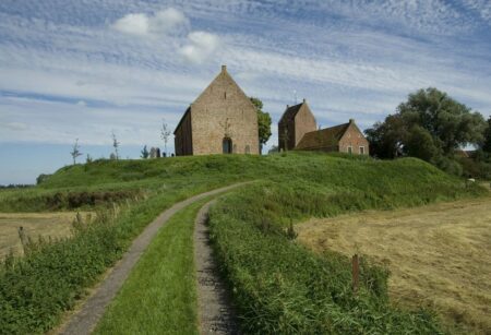
During a visit to the Wierdenland Museum in the Groningen village of Ezinge, I discovered a fascinating connection between the Etruscans and the inhabitants of Ezinge: water management. Although the Etruscans never set foot in Ezinge, they shared the same struggle against water. The inhabitants of Ezinge built their villages on artificial mounds, known as “wierden,” to stay dry during floods. Using a topographic map, we can now see exactly how they—and other villages in the area—lived on these mounds.
Such a topographic map, also known as a Digital Elevation Model (DEM), reveals more than just the location of the mounds; it also shows how parts of these hills were excavated—often during World War II—to obtain fertile soil. In addition, we see that the surrounding farmlands are convex fields, where the center of the field is higher than the edges—a clever technique used for drainage.
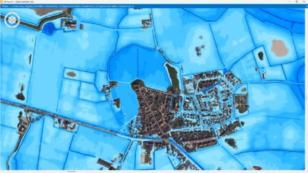
By digitally analyzing this historical landscape, we can simulate what would have happened if sea levels had risen back then. We can then see exactly which parts of the land would have been submerged and which areas would have remained dry. The excavations of the mounds also become clearly visible. The best part is that the remaining part of the mound perfectly demonstrates how effective this ancient technique was in protecting against high water.
In this way, modern technology brings the past to life and offers valuable insights for the future.
Framework: Current Elevation Data for the Netherlands (AHN)
The AHN is available as Open Data. This means that anyone can use the data for free and without restrictions. Both the raster data and the point clouds can be downloaded via PDOK and the National Georegister. The AHN is available as a LAS (LIDAR Aerial Survey), also known as a point cloud.
How does rainwater drain away in Ezinge today?
Rounded fields and mounds: ingenious techniques from 2,500 years ago for managing water. But what about today?
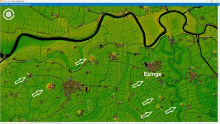
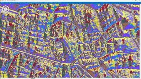
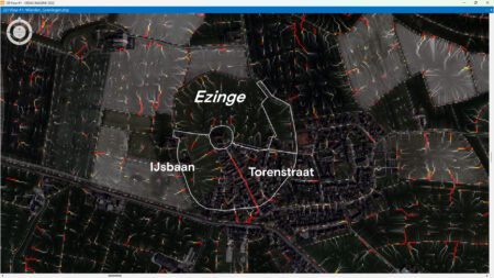
Using the Digital Elevation Model (DEM) and a calculation, we can see exactly how rainwater flows away in Ezinge today and where flooding might occur during heavy rainstorms. The computer first generates a visual pattern, but to make it truly understandable, we combine this data with aerial photographs. By linking the analysis of remote sensing to geographic data, it immediately becomes clear which streets and fields may be affected by flooding.
In Ezinge, you can see that during heavy rainfall, a lot of water flows away via Torenstraat. You can also see that a lot of water flows toward the ice rink. remote sensing easy remote sensing such complex issues. As I’ve shown, a dataset like the Actueel Hoogtebestand Nederland (AHN) provides valuable insights into the landscape. You can see exactly where flooding might occur and where flood retention areas may be needed.
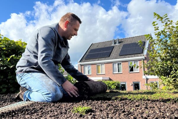
But there are so many more possibilities with a Digital Terrain Model. In the next section, I’ll use the AHN to identify the best locations for solar panels and green roofs.
Ezinge, Groningen
Ezinge is a small village in the province of Groningen, located in the municipality of Westerkwartier, and it has a particularly rich history dating back to prehistoric times. What makes Ezinge especially interesting is that it is one of the oldest continuously inhabited places in the Netherlands. Although Ezinge is now a small and quiet village with only a few hundred residents, it still attracts visitors interested in archaeology and history. It is a place where the past literally lies beneath your feet, and it offers a fascinating glimpse into the history of the Netherlands, particularly into how people adapted to and lived in a changing landscape.
More information
Harald is a Business Consultant at IMAGEM. He bridges the gap between business, sales, and technology, and focuses on delivering value to the client. He collaborates with developers to create solutions for the public safety and security sector, educational institutions, and digital twins.
Would you like to learn more about this topic? Send Harald an email or send a message via our contact form.

Harald Görtz
Business Consultant