3D technology is no longer the exclusive domain of gamers who stay up all night racing and battling monsters. The same technology is now being used for “real-world” applications: from smart cities to air traffic control. But how can an engine that was once intended to bring virtual worlds to life suddenly be crucial for large geospatial projects? In this article, we dive into the striking differences between geo-engines and game engines. Because when it comes to accuracy, scale, and reliability, a geo-engine like Luciad turns out to operate Luciad a completely different league.
The power of a game engine
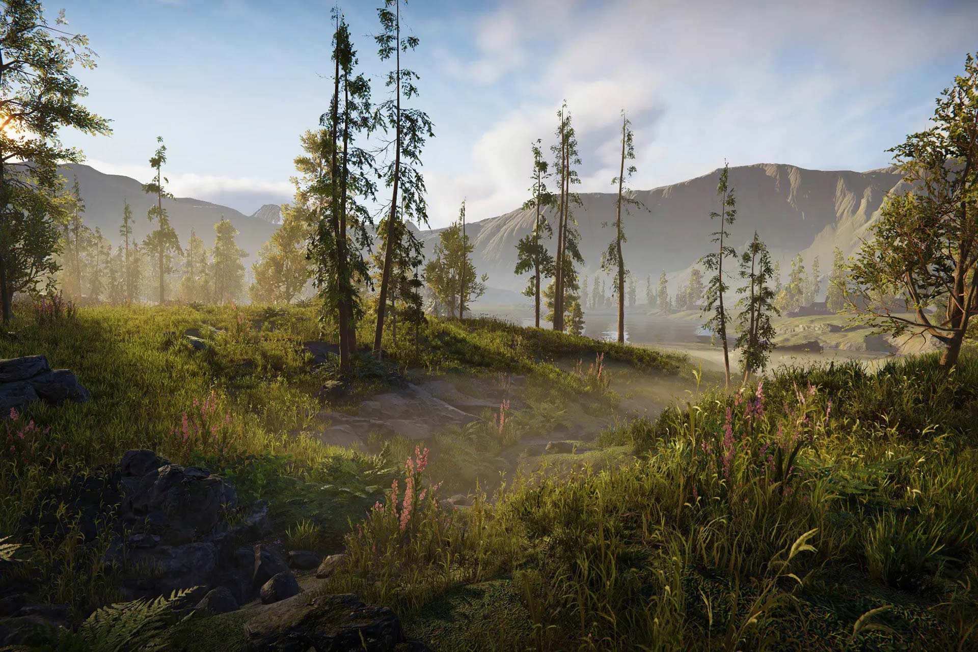
Game engines, such as Unity, Unreal, and Godot, are designed to maximize interaction, spectacle, and speed. They support a wide range of visual effects, physics, and scripting that immerse players in a compelling experience. From dynamic lighting to ragdoll physics, everything is geared toward bringing the imagination to life.
What’s more, the community surrounding game engines is impressive. Tutorials, plugins, and examples are easy to find. Whether you’re building a simple platformer or a hyper-realistic racing game, the foundation is already in place. Sounds ideal, doesn’t it?
But what if you used that engine for something completely different from an epic quest? For example, to simulate an entire city, complete with real-time traffic and geographically accurate map projections. Could you pull that off with an engine that wasn't originally designed for that purpose?
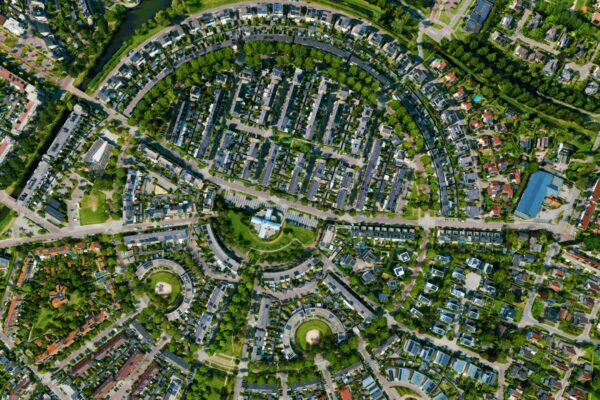
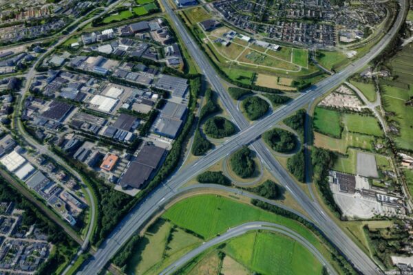
Geo-engine: The World Takes Center Stage
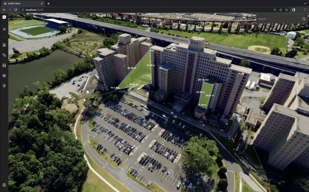
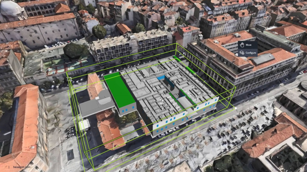
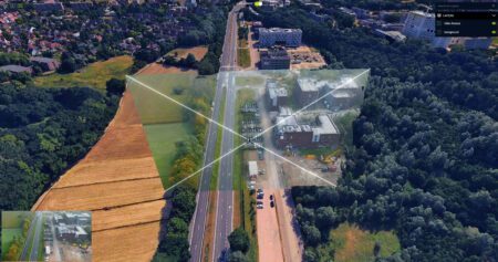
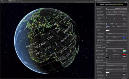
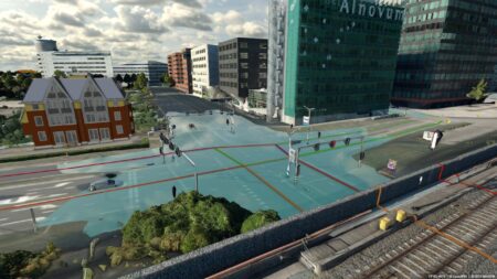
A geo-engine, such as Luciad, focuses not on the game but on the real world. The software is optimized for processing massive amounts of geospatial data, ranging from vector files and satellite imagery to live data streams from sensors and drone footage. Whereas game engines are primarily geared toward visual spectacle within a defined scene and focus on a specific part of the map, a geo-engine takes a fundamentally different approach:
-
Not just random “x, y, z” coordinates, but the National Triangulation System (RD) or WGS84, UTM, and other projections you need to combine local and global maps.
-
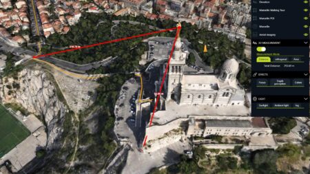
Line-of-sight, elevation profiles, and measurement tools are available out of the box, without having to dig into the code for mathematical tricks.
-
Whether you're visualizing a single neighborhood or an entire continent, a geo-engine can handle that scale and prevent your project from being overwhelmed by the volume of data.
-
Geo-Engine is software specifically designed for large organizations to support complex, large-scale processes. These are typically robust, scalable, and secure systems. Geo-Engine is optimized for easy integration into any architecture.
A geo-engine stands for reliability and precision. These aren’t exactly the features a gamer is looking for, but they’re essential when making decisions based on visualizations—such as in infrastructure planning, security monitoring, or disaster response.
"For those who choose Unity, for example, they will encounter limitations in that they cannot visualize the relevant (geo) plugins 'client-side' in the browser."
— Corné Helmons
A look at how it works in practice
We spoke with Joris Schouteden, R&D Director atHexagon, to gain a better understanding of the technological aspects of a dedicated geo-engine. He has been working for years on the implementation and integration of Luciad within the Hexagon and gives us a glimpse into the world of geospatial data, real-time streaming, and coordinate transformations.
In your opinion, what are the biggest technical challenges involved in processing large geospatial datasets in 3D?
“Everything has its value and its place,” Joris begins. “One significant trend we’ve been seeing lately is the widespread adoption of hybrid solutions. We’re currently collaborating with Nvidia to visualize reality capture, digital twins real-world models at various levels. What we’ve noticed is that the standard formats used in the geospatial industry are difficult to process at scale within game engines.”
Joris continues: “For smaller scenes—such as when a client asks us to visualize a townhouse with a high level of detail and visual fidelity—we consider creating those 3D scenes using photogrammetry or point-cloud meshes. We can then apply real-time ray tracing to them. But if you want to do more with it—such as using sensor data and adding all kinds of vector data—it becomes a lot more difficult. Technically, it is possible to achieve this in a game engine, but it’s not easy.”
“Visuals aren’t unimportant, but they aren’t the most important thing. From a geospatial perspective, we naturally try to visualize PBR (Physically Based Rendering) shading and processing aspects. Shadow analysis is something that does occur in our field, but ray tracing isn’t particularly relevant.”
From the perspective of municipal practice
Corné Helmons, Advisor Digital Twin, GeoBIM, and Standardization at HCI Infra BV, also sees the differences. He has led digital twin for clients including the municipalities of Rotterdam and The Hague. He shared his vision for applying his work using a game engine:
“The biggest technical challenges we face mainly have to do with the accuracy of our data—specifically, ensuring that the georeferences are correct and kept up to date. We took a training course on how to use a game engine, and it works like a charm,” he says with a smile.
Corné pauses to think for a moment and continues: “We do notice that there are limitations to the scalability of our data processing.” That’s why I challenged the management team to form partnerships with other organizations that can help us with this, such as IMAGEM, whom we met during our trip to the Smart City EXPO event in Barcelona.”
Why a geo-engine makes a difference
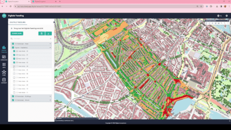
So why not just customize a game engine yourself? Theoretically, it’s possible, but you’ll quickly end up with a Frankenstein’s monster full of workarounds. With a specialized 3D geo-engine (such as Luciad), all the functionality comes ready-to-use out of the box: you add geo-data, and the system knows how to project it, how to manage zoom levels and layers, and how to perform real-time GIS analyses. So you’re not constantly figuring out how to make it work yourself. What immediately stands out here is that the engine not only requires computing power but must also be able to handle different map projections intelligently. This confirms the unique nature of a geo-engine compared to a general-purpose game engine.
Here are a few advantages of a dedicated geo-engine:
Save a significant amount of development time
With a geo-engine, you don't have to spend endless hours tinkering with coordinate transformations, integrations with GIS platforms, or real-time streaming—they're all built right into the software.
Better performance with large datasets
Game engines struggle to handle massive amounts of dynamic geospatial data. Geo-engines are designed to allow users to zoom effortlessly from continents down to the city level.
Professional reliability
Geo-engines are used in defense, government, aviation, and security applications. They undergo rigorous testing and support industry standards, ensuring the accuracy of your data.
Easier maintenance and support
If you integrate with an existing geo-ecosystem, you can count on specialized support and updates. You won’t have to rely on game engine “workarounds,” generic plugins, or hobby projects.
What technical modifications are required to integrate this engine with existing GIS infrastructure or to connect new data sources?
Corné: “Well, that’s exactly the core issue we’re currently facing at the City of Rotterdam. The way I see it, the Open Urban Platform (OUP) will serve as a hub connecting a vast amount of data, allowing us all to align the same references, BIM models, and datasets. That way, it won’t matter whether we Luciad with Unreal or Luciad —we can be confident that the data is accurate, or at least acceptable for the project we’re working on. The goal should be the result, not the path to it.
For now, our platform is designed for visualization without a "Z-component," so we use a flat surface. This doesn’t matter for BIM models because they don’t incorporate any curvature either. This makes things easier for all of us, given the size of our work area within Rotterdam. Moreover, our geolocation generally works quite well, as long as we stick to the NAP level. However, as soon as we start working on larger-scale projects, such as the Groene Boog or a tram line from the beach to the city center, we do run into challenges.”
Joris adds: “Datasets are always so large that, as soon as you want to stream visualizations and work with a high level of detail, you face different challenges. Game developers have been dealing with this for years, often relying on manual work to ensure that everything looks and functions properly. For example, within a room or space, they know that the outside world is omitted because it doesn’t need to be displayed. As a result, the engine doesn’t have to render that data, which ensures optimal use of the hardware.”
“For example, a church tower in the distance might be rendered less sharply. You can adjust that manually, but it remains a challenge to tailor the right ‘level of detail’ to the situation. We’re also seeing hybrid environments being created that we load into Unreal using our datasets. We have clients who render 3D data processing and 3D tiles exclusively in the Unreal Engine, but then load them via Luciad. This demonstrates the flexibility of this engine in combination with our platform, allowing us to adapt relatively quickly and effectively based on the client’s needs.”
What kind of skills are needed to work with a geo-engine, and how does that differ from working with a game engine?
“In a game engine, you start with a 3D mesh environment,” Joris explains. “You need to be familiar with that domain; on the display side, you need people who can program using tools that are similar in both a geo engine and a game engine. It’s just that the APIs we offer are at a higher level than what the typical geospatial user needs, but they can’t be easily applied in a game engine. Currently, that still requires a lot of customization and manual adjustments to achieve the desired result.”
Corné shares his perspective: “As I mentioned, we’ve gained plenty of knowledge through training. But of course, it helped that I already had some familiarity with Unreal itself. I do know, however, that for the project we’re working on, it’s essential that a suitable plugin be developed or made available for us to use. So far, we’ve received sufficient support from our partners in this regard.”
He continues: “While we’re currently focusing on a desktop application, we naturally want to move toward something that runs entirely in a browser and is easily accessible to everyone. This requires sufficient rendering capacity, and the (limited) technical obstacles must be resolved. The advantage of our approach is that our plugins are fully available and accessible from the desktop or server-side. Other parties that opt for Unity, for example, will run into limitations where they cannot visualize the relevant (geo) plugins ‘client-side’ in the browser. Or worse yet, they’ll have to develop a ‘workaround’ for that themselves. I don’t think a municipality would want that.”
What excites you when you think about the visualizations in the engine you work with?
Joris really loves the versatility and variety in all the data that’s collected: “What I enjoy is the diversity and sheer volume of data that’s generated. Take data collection (measuring, scanning, etc.), for example, where data is generated in all sorts of different ways and formats. But also the analyses we can apply to aerial photos, data, and real-time video as they’re collected, which can yield surprising results. All this data and the challenge of bringing it all together is what motivates me to get out of bed every day.”
Corné is primarily interested in the availability and speed with which data can be applied: “I think that IMAGEM Luciad , is Luciad very good addition to the OUP, offering the perspective and scale needed to approach the entire world. Especially for public datasets we access from other municipalities, this can make it easier to seamlessly align digital twin beyond our own scope. If we can then get all the georeferences to align and use the same standards, I think the world would already look a lot better.”
The Blurring of Worlds
The line between the virtual and real worlds is blurring. 3D engines from the gaming industry offer us visually stunning, realistic environments and an immersive gaming experience. But anyone who wants to visualize the real world accurately, reliably, and at scale is better off with a geo-engine like Luciad. For professionals who make decisions based on data, this isn’t a luxury—it’s a necessity.
Want to get started with digital twins yourself?
Ready to make the leap from fantasy worlds to the “real deal”? Invest in a geo-engine and discover how you can shape the real world to be just as dynamic as your favorite game. Email Niels at imagem or send a message via our contact form.
More information
Niels is the Government Market Manager at IMAGEM. He helps government agencies continuously work smarter and more effectively, and fulfills his role by supporting organizations in solving their challenges. Want to learn more? Send Niels an email or send a message via our contact form.

Niels van de Graaf
Government Market Manager