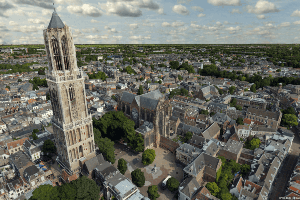
As a municipality, infrastructure manager, or landscape analyst, you want to map an area quickly and accurately—for example, for urban planning, traffic analysis, or environmental monitoring. Whereas in the past, methods for creating 3D models were slow, costly, and complex, it is now possible to generate realistic and detailed 3D models—meshes or shape models—within minutes. In particular, the use of a (relatively inexpensive) drone and smart software makes all the difference. For a fraction of the time, cost, and effort.
Why Accurate Data Is Essential
Large-scale infrastructure and construction projects demonstrate how important it is to have the right data from the very beginning. In the past, projects were delayed or encountered unexpected complications due to incomplete or inaccurate information about soil conditions, existing structures, or changing environmental factors. This led to costly modifications, delays, safety risks, or even damage to existing buildings and infrastructure.
What’s more, it required a great deal of specialized knowledge: you needed surveyors to take measurements, photographers or pilots to capture aerial images (back then, often from an airplane rather than a drone), and GIS experts to piece everything together. By the time you had a usable, coherent 3D model, weeks or even months had easily passed. That made it financially or practically unattractive for many parties to start using 3D models.
Modern technologies such as drones and photogrammetry can significantly reduce these risks. By conducting frequent and detailed scans, changes in the environment are identified at an early stage. This results in a more efficient process, better communication with stakeholders, and greater predictability regarding the project’s progress.
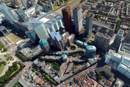

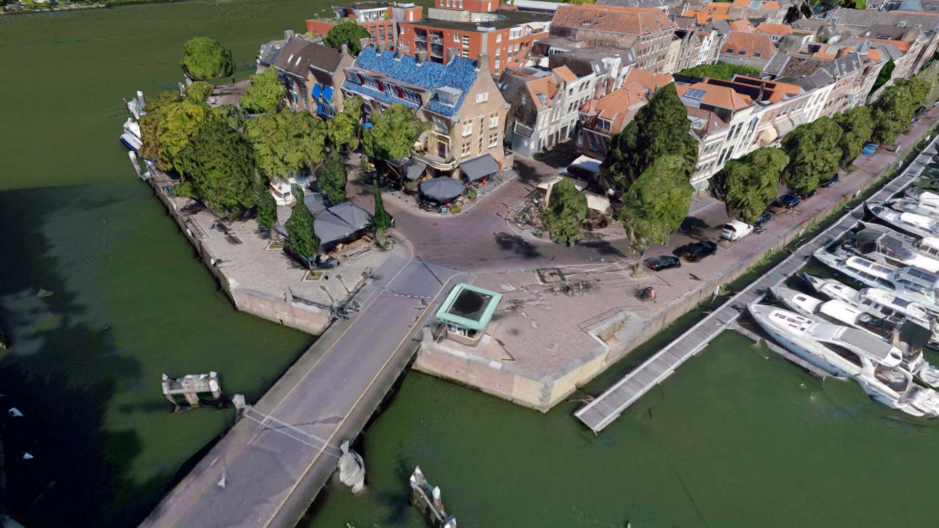
From drone photo to digital twin: it’s that simple!
Within 15 minutes, you’ll have an interactive digital twin you can immediately use for analysis, visualization, and communication with all relevant stakeholders. We’ll guide you step by step through the process: from the moment the drone takes off to the finished 3D model in a viewer accessible anywhere in your browser. This way, you can see for yourself how easy it is to build a virtual world with the right tools and expertise.
Curious to see how this works in practice? In this article, our colleague Reinier de Graaf shows you how to convert a drone photo into a detailed 3D model in our 3D viewer in five simple steps.

How it works
- Video footage: A drone captures the footage from various angles and heights.
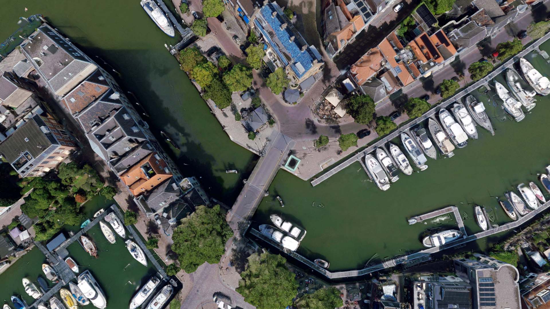
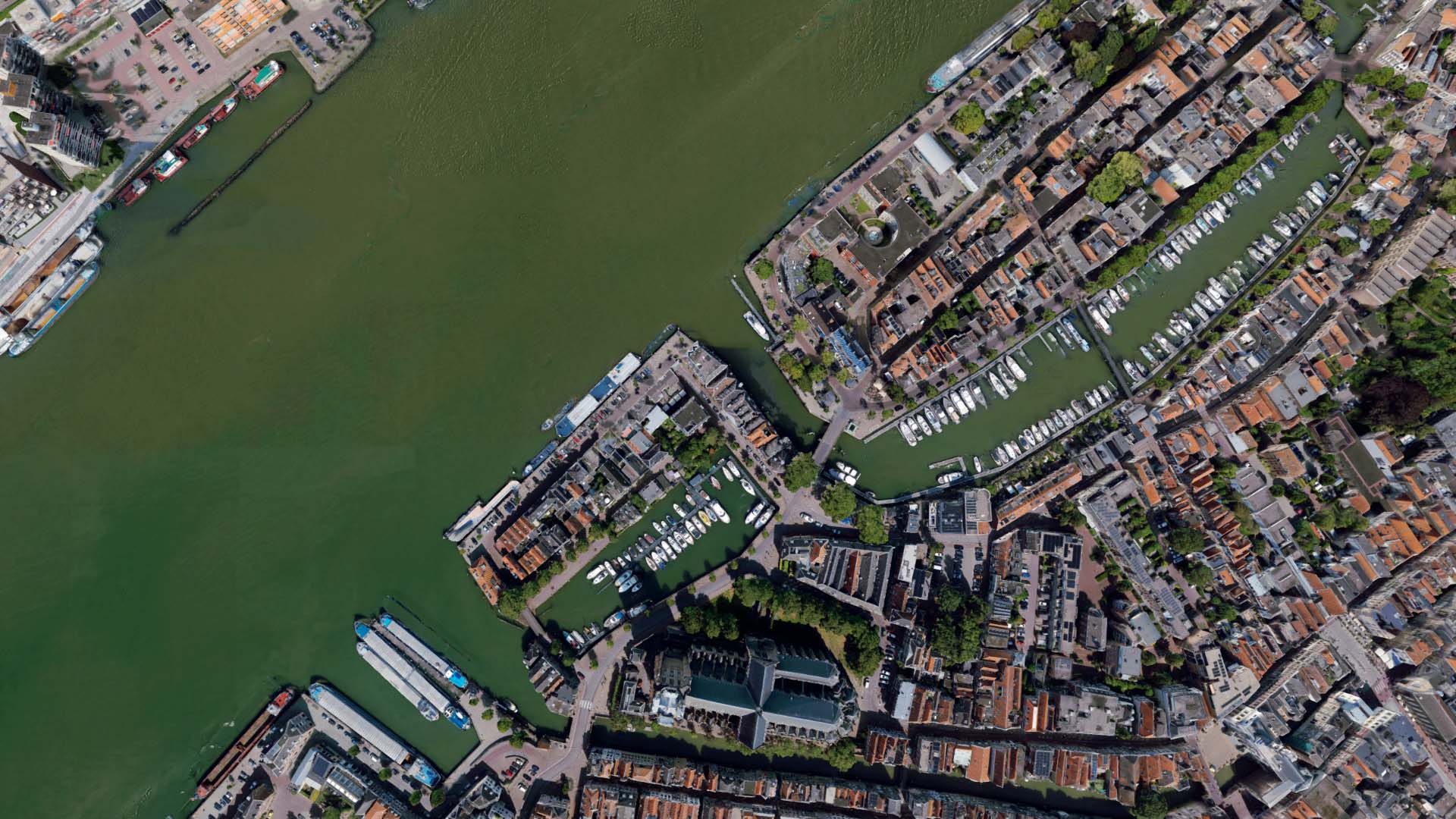
- Automatic processing: ImagineUAV (or a similar program for drone photogrammetry processing) converts these images into a realistic and accurate 3D model. The software identifies overlapping points in the photos and builds a mesh of the terrain.
- Textures and level of detail: Textures are projected onto the mesh so that the 3D rendering looks realistic and details such as buildings, roads, and vegetation are clearly visible.
- Proper implementation: With Luciad , the model is loaded into the environment where the digital twin is digital twin . This process is simple and fast.
- Use in simulations: The model is loaded directly into a simulation environment, where it can be used for analyses and visualizations, ranging from urban planning to crisis management.
What is photogrammetry?
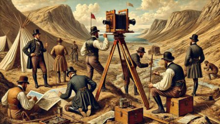
Photogrammetry is the technology behind this fast and accurate 3D modeling. As early as 1851, the French geodesist Aimé Laussedat used photographs for surveying. Until recently, creating 3D models of the built environment was a time-consuming process that required specialized knowledge. Manual measurements, complex calculations, and data merging took weeks or even months.
Thanks to drones and advanced software such as Luciad , this process is now incredibly fast and accessible. Whereas data collection and integration used to be the biggest challenge, it is now possible to generate an accurate point cloud or mesh based on dozens or hundreds of drone images.
A huge leap forward with Luciad
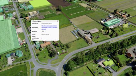
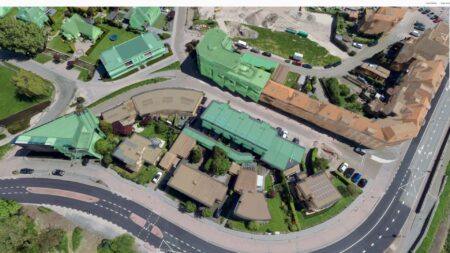
The principle is simple: you take multiple photos of an object or terrain from different angles. You then use software like ImagineUAV to analyze the photos and calculate depth, shapes, and distances, thereby converting the drone imagery into a 3D structure with high precision. This creates a detailed mesh or shape model, complete with textures that realistically depict the object or area. Of course, it’s also possible to process these shapefiles and meshes using a different software package; our platform works with all open standards, including OGC 3D Tiles. We then place these in our digital twin via Luciad , ensuring that all coordinates are positioned correctly and accurately.
In no time at all, you’ll have a lifelike digital model that you can use as the basis for simulations, visualizations, or analyses in a digital twin. All in all, the entire process—from the drone flight to the 3D rendering in our 3D viewer, Planspace Simulator—takes no longer than 15 minutes. That’s a huge time savings compared to traditional methods!
Nowadays, you can visualize details at every level. This also makes it easy to discuss the implications of plans in a realistic representation.
The benefits and solutions at a glance
The combination of photogrammetry, ImagineUAV, Luciad , and a Planspace Simulator offers valuable applications:
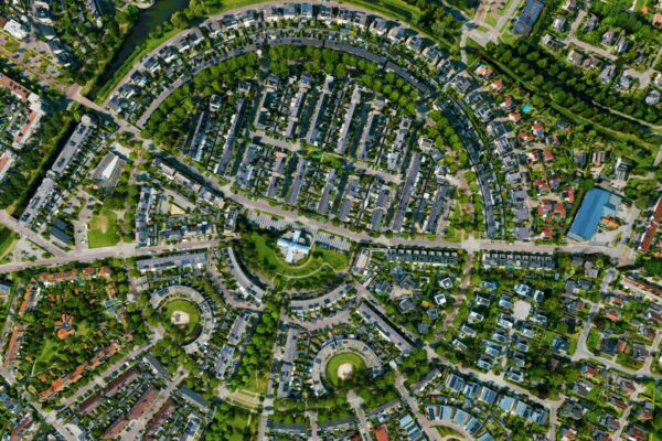
- Urban and Regional Planning: Municipalities or project developers working on new residential neighborhoods, the redevelopment of public squares, or the design of green spaces benefit greatly from an up-to-date 3D model. You can easily simulate the integration of new buildings or infrastructure and quickly see how they relate to the existing environment.
- Infrastructure and mobility: Think of planning new roads, bike paths, or public transportation routes. With a 3D model, you can visualize and optimize traffic flows and routes in advance. This gives you quick insight into potential bottlenecks, such as roundabouts, intersections, or bridges.
- Training and security operations: Realism is crucial in crisis management and security exercises. A detailed digital environment allows emergency services to practice responding to emergencies in a lifelike simulation. An accurate digital twin also provides digital twin safe and interactive training environment for military and police exercises.
- Environmental management and monitoring: Photogrammetry helps document and monitor nature reserves, coastlines, and waterways. By flying drones on a regular basis, you can accurately monitor changes in vegetation, erosion, or water levels. This is ideal for identifying problems early on and taking appropriate action.
- Heritage Preservation and Cultural Research: Historic buildings and archaeological sites can be fragile. A 3D model based on drone photography provides a virtual archive that captures in detail what these sites look like today. This enables researchers, conservators, and policymakers to make better decisions regarding conservation and restoration.
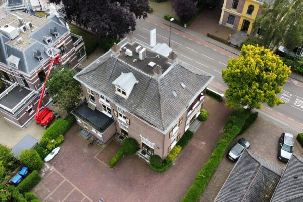
- Real Estate and Marketing: A 3D tour of a building or property says more than a hundred photos. Real estate developers and agents can use 3D models to give potential buyers or tenants a realistic view of a location, even if it isn’t quite finished yet.
How does this benefit your municipality or organization?
Thanks to the rise of drones and specialized software, many of the old challenges are now a thing of the past. Whereas data collection (and merging that data into a 3D model) used to be the biggest bottleneck, you can now quickly generate an accurate point cloud or mesh based on dozens, sometimes even hundreds, of drone photos. This makes the process:
Fast and efficient
With just one or two drone flights, you'll have enough footage to reconstruct an entire area in 3D.
High accuracy
Modern photogrammetry algorithms deliver accurate results with a minimal margin of error.
Easy integration
The visualizations are user-friendly and self-explanatory.
This means we now have the technological tools to create models at a much greater level of detail. This helps cities and businesses identify potential issues—such as soil conditions, elevation differences, or narrow alleys—early on. As a result, costly surprises, which were common in the past, are much less likely to occur.
Given this versatility and these possibilities, it’s no surprise that photogrammetry and 3D simulation are rapidly gaining popularity. Whether you’re working on urban renewal, emergency response training, or cultural heritage preservation, the benefits of a reliable and scalable digital twin enormous!
More information
Reinier is the Product & Project Lead at IMAGEM. As Product Owner of Planspace Simulator heSimulator closely involved in translating customer needs and market developments into a user-friendly digital twin that anyone can use. With his full commitment and knowledge of digital twins , he digital twins to digital twins the living environment of tomorrow. Want to learn more? Send Reinier an email or send a message via our contact form.

Reinier de Graaf
Product & Project Lead