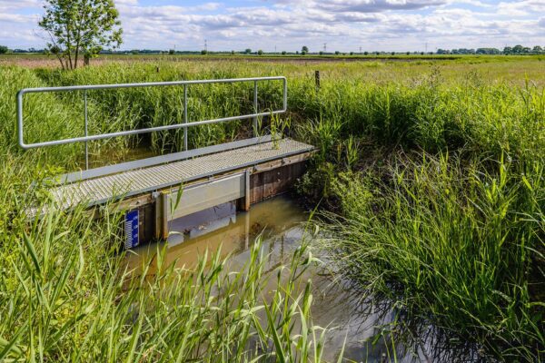
To make the right decisions at the right time, you need an up-to-date and comprehensive picture of the operation. And that always starts with the right geographic data. Requesting and delivering that data—such as satellite imagery and maps—must always be simple and fast. The Geography Service (DGEO) is on top of this, and with the arrival of Geoportal 2.0, they can efficiently provide every branch of the armed forces with the right data.
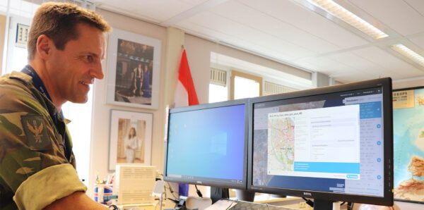
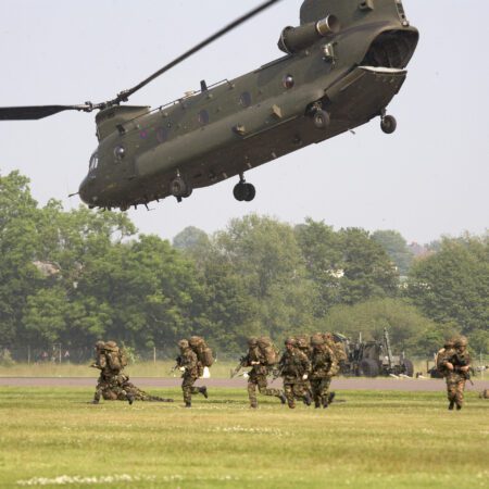
A member of the military since 1988 and involved in geoinformation since 1999: Major Marcel van Loon started out as an infantryman and has become an expert in the field of geography over the past 23 years. And as commander of DGEO, he understands better than anyone the importance of accurate maps and other geospatial data during an operation, whether in a foxhole or at the DGEO office. It is often said that without geospatial information, there is no operation.
Undergoing renovations
As an infantryman, he used the current geoportal, the Ministry of Defense’s online search tool for finding the right geographic data. But it left a lot to be desired: “When I searched for a topographic map, I couldn’t find anything. Or maybe I did find a topographic map, but it was of a completely different area. Eventually, I was able to find the right map, but it took far too long. There were too many issues with both the data’s discoverability and its user-friendliness.”
That wasn’t just his experience; the Geoportal 1.0 needed an update and had to keep up with the times. So a change was needed. It had to become an environment where a soldier could find the right data on their own, whether they were at sea, in a foxhole, or in the air. It had to be interactive and intuitive for the user, and the path to accessing the data had to be shorter. Van Loon: “In Geoportal 2.0, we ensure that users can search for and find data faster and more easily. Moreover, users can immediately see what data they’re looking at, without having to read a manual.” Where there used to be a code that was only recognizable to DGEO, there is now a legend, making the maps recognizable to every user.
The ordering process has also been simplified. “It has become a kind of online store with a shopping cart where you can easily order the data without an intermediary or long wait times. And if the data isn’t available, our front office receives a notification to order it for the user in question.” Ordering maps from international partners or through a commercial channel begins this way. Once the data arrives, it is made available on the geoportal.
You can't do without good geographic information
— Marcel van Loon, Geography Department

Anytime, anywhere
Geoportaal, an application developed by ONEPORT, is a service for the entire defense organization: the Army, Air Force, Navy, and Military Police. It is primarily designed for digital data, but there is also a need for users who require paper maps. “If I need a paper map, I have to go to the Geoportal, add the maps to my shopping cart, so that the delivery service can drop them off where they’re needed without further physical intervention from DGeo,” explains Van Loon.
This is also coordinated at the international level. When the Air Force conducts an exercise with French Army troops, both parties have access to the same data. This is crucial to the “Operating off the same map” principle. A major advantage of the new Geoportal is that it serves as a central hub where DGEO can manage everything. Both users and DGEO staff can easily find the right data. Furthermore, DGEO can easily verify that the most recent datasets are included in the catalog and that older datasets have been removed.
In times of war and conflict, geographic information is always needed.
— Marcel van Loon, Geography Department
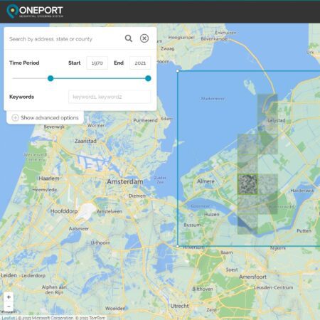
ONEPORT
“Once that’s taken care of, we don’t have to worry about it anymore. And users now know that when they visit the Geoportal, they can always find the most up-to-date data.” Geoportal 2.0 was developed through close collaboration with IMAGEM business consultants IMAGEM is a custom solution based on the product ONEPORT. Van Loon is enthusiastic about the collaboration and the result. “I get the sense that IMAGEM from the user’s perspective. The interaction is very natural. A problem is identified and addressed. I feel that it’s customer-focused and less commercially driven.”
“In times of war and conflict, geographic information is always needed,” says Van Loon. “You can’t do without good geographic information. All planning and situational awareness depend on it. In the future, there must be a system that can present all information to the user in a centralized manner. And DGEO must provide the foundation for this information-driven action (IGO). It must be available, searchable, in all formats on all devices, and at the international level.” And with Geoportal 2.0, the Ministry of Defense has already taken a significant step in that direction and laid a foundation to build upon.
More information
Robbert is a Business Consultant at IMAGEM. He specializes in geospatial applications and focuses primarily on the defense sector. In recent years, he has gained in-depth expertise in photogrammetry, remote sensing drones. He also serves as a project manager and Security Officer (SO).
Would you like to learn more about this topic? Send Robbert an email or send a message using our contact form.

Robbert van Bussel
Business Consultant