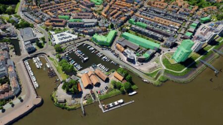
The Luciad delivers geospatial software solutions that enable the world’s most critical operations. Through advanced visual analytics, it unlocks the potential of real-time location intelligence. This lays the foundation for the next generation of 5D geospatial systems—from securing critical assets to creating the digital infrastructure for smart cities. This technology helps users implement intuitive command and control systems. You can rely on the Luciad for high-quality visualization that enables the implementation of scalable solutions.
Luciad
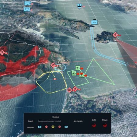
LuciadRIA is the answer to today’s demand for powerful, lightweight browser-based applications. LuciadRIA is powered by today’s most advanced web technologies. It uses WebGL, HTML5, and JavaScript to deliver desktop-like performance to your web applications.
Luciad
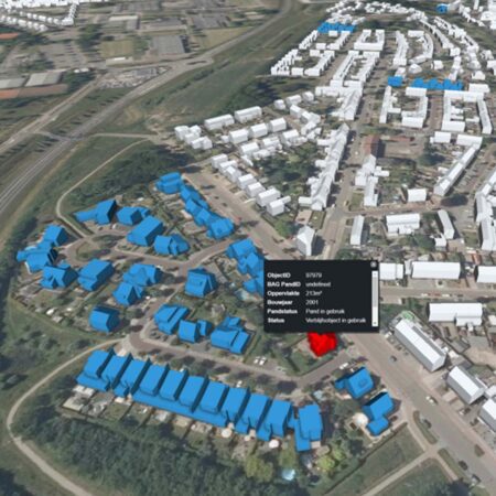
LuciadFusion is an all-in-one server solution for your data publishing workflow and geospatial data management. With LuciadFusion, you can intelligently manage your data, store and process a wide range of data formats, and send data to numerous applications.
These applications simplify the lives of developers and end users with advanced visual analytics, enabling them to unlock the potential of real-time location intelligence and lay the foundation for the next generation of 5D geospatial systems. From securing critical assets to creating the digital infrastructure for smart cities, this technology helps users implement intuitive management and control systems. You can rely on the Luciad for high-quality visualization that enables them to implement scalable solutions.