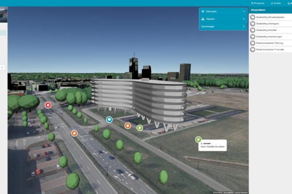

Are new developments in line with current policy? And what happens when you adjust certain parameters in these developments? These questions, among others, formed the basis for the collaboration between the city of Almere and IMAGEM, a company specializing in geodata. The result of this collaboration is Planspace, an application that digital twin together policy principles and digital twin . “It’s just magical,” says Henk Hoogland, department manager at the municipal agency, enthusiastically.
Planspace policy principles together with digital twins
A digital twin a virtual simulation model that replicates the final situation. Eliane Marcelis is a business engineer and consultant at IMAGEM. Her work focuses on knowledge modeling and the development of applications using policy models. At the same time, she recognizes the power of combining geoinformation with digital twins.
Together with colleagues from the municipal agency, Marcelis Planspace . “Within Planspace , we Planspace policy principles with digital twins. What emerges is a virtual model that provides insight into various scenarios,” explains Marcelis. “And now, when someone asks what it would mean if traffic flows increase, you can show that Planspace using Planspace ,” adds Hoogland.
Read the article about Planspace
This was a short excerpt from Elianne’s full article in InControl Magazine. Click the button below to read the rest of the article.