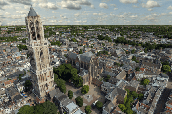

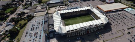
The hills stretch across the landscape, dotted with beautiful nature reserves, caves, and picturesque villages. South Limburg. This is the operational area of the Data House, a government organization focused on collecting, managing, and providing information from (basic) registries for the municipalities of South Limburg and the Limburg Water Board. And that landscape presents plenty of challenges for the Data House. To tackle those challenges, they launched a pilot project to address their processes in 3D.
Sjef Leenen is the director and secretary of the Gegevenshuis. The organization has a strategic agenda focused on growth and innovation. “It is my job to ensure that both pillars of that strategic agenda are constantly evolving. In addition to steering Gegevenshuis, I’m particularly busy with these two areas,” says Sjef. Innovation has been a key pillar since the organization’s inception, especially because the geospatial sector was undergoing rapid development and was at the heart of the digital revolution. “When we started, we were perhaps too focused on how we could innovate our processes. How can we work as effectively and efficiently as possible?”
The move to 3D
Once their internal processes were in order, it dawned on them—especially on the clients—that they were sitting on a goldmine: data. Data that is essential for solving issues and challenges in the local area. “We increasingly realized that we could do so much more with geodata,” Sjef explains. “We also call it ‘white gold,’ a nod to the past, when coal was the region’s ‘black gold.’” And with that data, a lot is possible. Especially in 3D.
The Data House had already been working with 3D technology as early as 2019. They participated in a national pilot project related to the implementation of the Environment Act. Sjef: “But it just wasn’t quite right. The software didn’t offer enough unique value for our clients.” That was until late 2020, when Sjef and his organization noticed that there was more momentum in the 3D space and the software was improving. “I thought, if we don’t jump on 3D now, we’re going to miss the boat somewhere down the line. I set up a 3D task force consisting of people I thought could make the transition to 3D. We started by looking at developments across the country: what’s happening in the software sector, where the expertise lies, and what solutions are working where.” And that led to the official pilot.
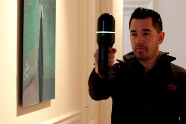
“We didn’t have the expertise in-house, so we started looking for suitable partners to provide support. Among others, we IMAGEM . I quickly realized that IMAGEM could be IMAGEM perfect partner to support us with 3D.” At the same time, Sjef had to take into account the organizational challenges involved in making such a transition to 3D, since everything had to be converted. Processes are being redesigned, data collection methods need to change—it’s changing in every way. “To advise us on this, we asked John Joosten from GeoBIMExperts to help us. The combination of these two partners worked perfectly, and the collaboration went smoothly.”
The goals
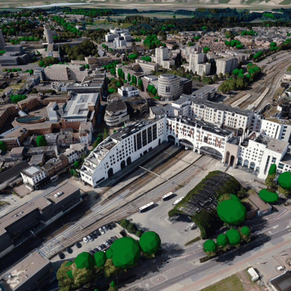
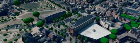
The pilot began with setting goals. “What do we want to achieve with this pilot? The risk with a pilot like this is that it can go in any direction. That’s why we adopted a project-based approach with two-week sprints to assess what was feasible and what wasn’t at each stage.” Over time, the goal shifted from 3D to digital twin. “For me, 3D is a three-dimensional representation of reality, whereas you digital twin a digital twin to run simulations and make predictions. That’s a much more dynamic environment, which increases the added value exponentially.”
Sjef was pleasantly surprised by the results. “I immediately saw a digital twin you can actually use. One that lets you see reality as it is, run simulations like greening roofs or flooding—which, of course, plays a major role in South Limburg. With digital twin like this, you digital twin predict where floods will occur, allowing you to evacuate in time and limit damage.” A year after the floods in the southern province, residents are still deeply affected. “With the right prediction, you can prevent the panic and damage. So the value of a digital twin like this digital twin no longer digital twin expressed in monetary terms.”
Where is this going?
Sjef has a clear vision for the digital twin the Data Hub: “We would digital twin further integrate the digital twin into the broader discussion on well-being currently taking place in every municipality—a discussion that brings together public order and safety, education, health, the economy, and other issues. These are then translated into the physical living environment. To do this, multi-year programs are set up, which means you have to collect a lot of information to assess the long-term effects of the actions you take.”
“I see the digital twin the platform where all municipal policies are brought together and interconnected, and where programs across all these areas are analyzed not only from a long-term perspective but also in relation to the other areas.”
More information
Niels is the Government Market Manager at IMAGEM. He helps government agencies continuously work smarter and more effectively, and fulfills his role by supporting organizations in solving their challenges. Want to learn more? Send Niels an email or send a message via our contact form.

Niels van de Graaf
Government Market Manager