
Imagine being able to “view” information without losing sight of the context. Imagine seeing a virtual world containing a digital replica of your surroundings—a digital world where predictive scenarios can be viewed from every angle, and one that’s accessible to everyone. What would it mean if you could see in advance what you want to implement in the real world?
Government is an administrative world. Many paper or digital documents are used to share information. This is also the case with urban development projects. Stakeholders and decision-makers review plans for how an area will be developed. They examine the available scenarios. And they study maps, tables, and graphs. Decisions are made based on this information. Choices are made based on individual interpretations. However, conducting a comprehensive assessment of competing interests is difficult and time-consuming.
From reading to understanding
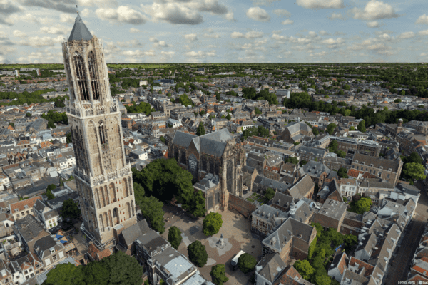
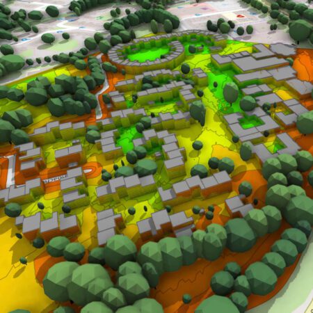
For the municipality of Almere, making urban developments understandable to everyone is a challenge. After all, how can you analyze and visualize the policy impacts of housing, mobility, climate, and employment in an integrated way? And how can you engage both the administration and citizens in envisioning future scenarios? Almere is grappling with this challenge, especially now that the city center is becoming increasingly densely built-up. But also for major challenges such as the energy transition, housing construction, and climate change. New solutions are needed. This calls for new—but above all, better—insights. A new way of “reading” information is therefore required.
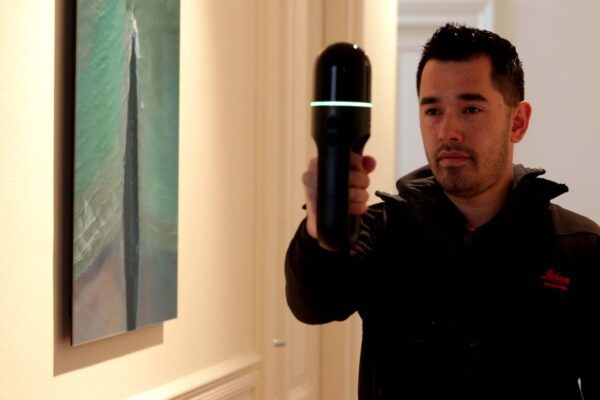
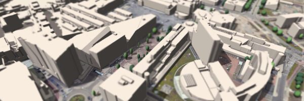
The solution lies in transitioning from flat information—such as a map or table—to a 3D visualization of reality. “3D is so much more than 2D,” says Willem Hartzuiker, a geo-economist with the City of Almere who is involved in this project. “You can show people maps, but that doesn’t appeal to them. 3D does; it’s the modern-day model. People recognize it: the trees, buildings, roads, their own living environment, and home.”
A unique collaborative environment
The City of Almere and IMAGEM jointly IMAGEM in the creation of a 3D collaboration environment where information can be visualized. Hartzuiker: “We’ve been working with IMAGEM for years IMAGEM the field of location technology. But the innovative collaboration environment we’re now developing together is unique.” This environment brings together information from all policy areas. Ambitions and objectives are digitized, providing immediate insight into spatial qualities. All stakeholders can jointly develop “what-if” scenarios and arrive at smart solutions more quickly through collaboration.
It is now possible to work comprehensively on plans, scenarios, and their implications. By automating laws, regulations, ambitions, objectives, and knowledge, the solution becomes policy-driven. And by using a digital representation of the built environment—the 3D city model—policies and scenarios become visible to policymakers and management. This enables them to make an informed decision.
Close to the people
The same information can also be taken “on the go” to residents to explain plans and discuss them transparently. There is no longer a gap in perception, and residents can see how their world aligns with the government’s. “Because what could be better than residents of Almere soon receiving a message in their inbox, clicking on a link, and being taken directly to the change in their own 3D online living environment?” Hartzuiker wonders. “Or if our residents can apply digitally for a permit for a dormer window or a shed and receive an immediate response?” Almere aims to be transparent and provide residents and businesses with equal access to information.
One truth
Almere and IMAGEM convinced that this approach is more effective and fosters greater engagement. A single, integrated information system with a single source of truth. This not only improves decision-making, but also shortens turnaround times and reduces costs associated with errors, thereby enhancing societal value.
With this smart, integrated information system IMAGEM the City of Almere and IMAGEM residents, business owners, city officials, and their own staff can see what the plan is and thus better understand it. This simple and clear approach fosters a new way of making decisions about where, how, and what can and may be done.
More information
Niels is the Government Market Manager at IMAGEM. He helps government agencies continuously work smarter and more effectively, and fulfills his role by supporting organizations in solving their challenges. Want to learn more? Send Niels an email or send a message via our contact form.

Niels van de Graaf
Government Market Manager
More information
Niels is the Government Market Manager at IMAGEM. He helps government agencies continuously work smarter and more effectively, and fulfills his role by supporting organizations in solving their challenges. Want to learn more? Send Niels an email or send a message via our contact form.
Niels van de Graaf
Government Market Manager