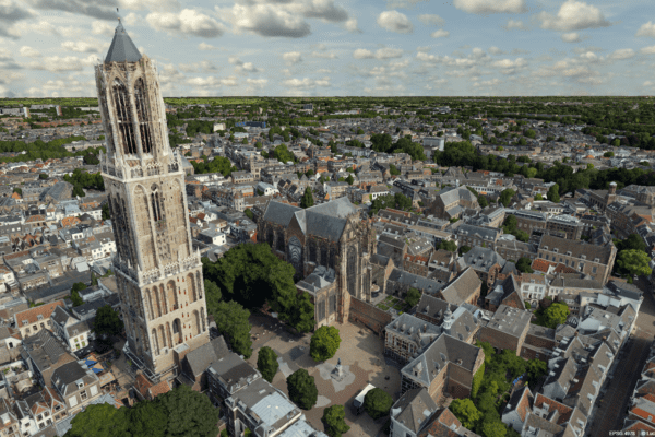

After nearly a year and a half, we were finally able to host our annual Make Geospatial Matter conference in person again. Whereas last year’s event was held entirely online, on Thursday, October 14, attendees were once again able to participate in person in various knowledge sessions, keynotes, and workshops, and network with one another at the Media Plaza of the Jaarbeurs Utrecht. “It’s fantastic to meet each other in person again; we’ve really missed this,” CEO Wouter Brokx remarked afterward.
Cat bells and context-aware
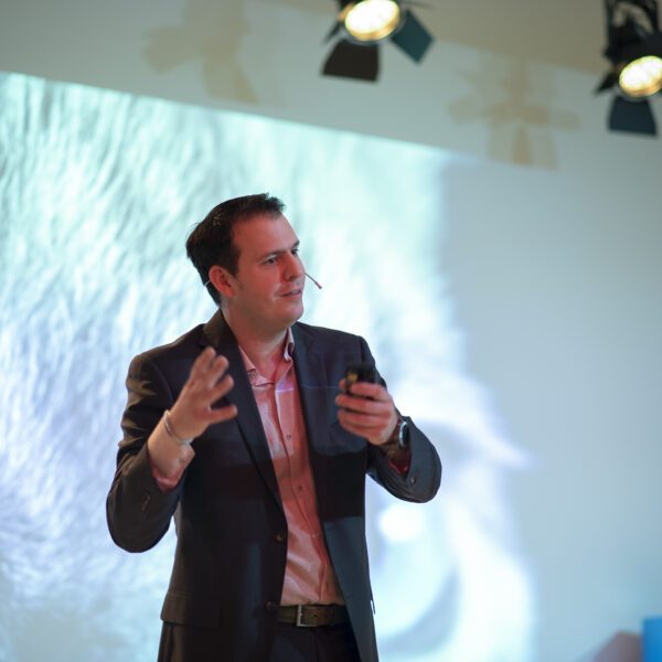
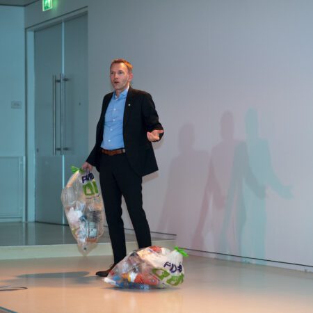
From data-driven to context-aware—that was the central theme of CEO Wouter Brokx’s keynote address. Being aware of your surroundings is not only crucial in the world of geotechnology, but in everyone’s life. By the end of the day, it became clear to the attendees why Brokx had stood on stage at the start of the day holding two large trash bags filled with plastic waste.
Bellingcat for policy: which cats are you putting bells on? That was the topic of Martijn Zoet’s opening keynote. Zoet is a professor (lecturer) at Zuyd University of Applied Sciences, as well as a consultant and speaker. He is known for presenting complex topics in an accessible way. And that was exactly what he did during Make Geospatial Matter. Everyone is familiar with the citizen journalism organization Bellingcat. Among other things, they investigated the MH17 disaster. The name is a play on “belling the cat,” or “tying a bell around the cat’s neck.” It’s derived from a classic fable about a group of mice trying to protect themselves from a cat’s attacks by secretly hanging a bell around its neck. In his presentation, Zoet applied this investigative method to the policy arena. With his interactive and energetic speaking style, he engaged the audience in his argument. Where do you hang the bells? In other words, what exactly do you measure to create good policy? And are you making optimal use of geo data in that process? The audience was clearly made to think about the potential of geodata. Zoet concluded his keynote with the inspiring line: “Geo solutions are a big canvas, so throw all the paint you can on it.”
In his keynote address, IMAGEM CEO IMAGEM Brokx explored the theme “from data-driven to context-aware” in greater depth. Brokx: “To determine what data we need, it’s very important to provide the right context. That may sound logical to us as humans, but it’s difficult for machines or artificial intelligence. To give an example: if you’re developing a system to detect speeding violations, you have to teach the system when 60 kilometers per hour is too fast. In a residential area, that’s way too fast, but on the highway, it’s actually too slow. But there are even more variables. For an ambulance, that same speed is acceptable in a residential area, but for a passenger car, absolutely not.”
“We humans have the ability and insight to turn that data into meaningful information. We can filter it, just as we do when talking to someone in a noisy restaurant. We can filter out all the sounds around us so that we listen only to the person speaking to us.” Brokx’s conclusion: “For good digital services, we need a next-generation system that is adaptive through focused listening and more empathetic and understanding through context awareness.”
Digital twin
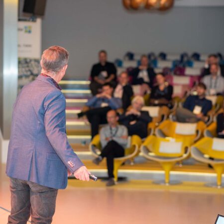
We invited clients such as the Ministry of Defense, the Air Force, the Municipality of Almere, and various technical partners to share their stories during the breakout sessions. Three technical themes emerged from these sessions: control information, data automation, and digital twin. In the area of control information, the Air Force was invited to demonstrate its solution for flight noise dispersion. In the main hall, Joey Ermens of the Royal Netherlands Air Force enthusiastically demonstrated how they can distribute their training and transport flights across the airspace using an interactive dashboard linked to flight data. This gives the Air Force insight into the noise pollution caused by their flights, enabling them to better distribute the flights—and thus the noise pollution—across the Netherlands.
In another room, a different branch of the Ministry of Defense was also speaking about management information. Joost Michael spoke on behalf of the Geography Service about the new geoportal for the Ministry of Defense: “The Geodata Portal was outdated and lacked user-friendliness, which is why the Ministry of Defense was looking for a new platform. IMAGEM this environment, based on the APOLLO platform and the new ONEPORT , which ensures that the Ministry of Defense has a modern and fully customizable solution at its disposal.”
The digital twin was covered extensively this year. Visitors could attend five different sessions, including an in-depth demonstration of digital twin , a project in which “enthusiastic experimentation was conducted in collaboration with IMAGEM.” An up-to-date 3D model was shown in combination with various types of data, which was immediately available internally and externally for purposes such as scenario creation. Cobra Groeninzicht digital twin another aspect of the digital twin . Joost Verhagen demonstrated the impact of trees on an environment. This is done using a “green” digital twin, which reveals down to the smallest details what trees can do for the living environment. With this digital twin , you digital twin see the tree’s health, how much space is available underground for new trees, and even when the color of the leaves changes.
GeoBIMExperts, in collaboration with the Limburg Data Hub, digital twin to get started with a digital twin . A common point raised was that the termdigital twinmeans something different to everyone, so where do you actually begin? Together, they recommended defining pilot projects across various (sub)domains, “but above all, to start small and take it step by step.” As a government agency, you must always establish a connection with the basic registries, because these will ultimately be displayed in 3D.”
Machine learning is becoming increasingly important
In the area of data automation, the discussion focused primarily on automated detection. For example, IMAGEM , in collaboration with several water authorities, IMAGEM the Schouw M.App inspection solution received a comprehensive update “to carry out inspections of blocked waterways even more efficiently.” The solution has now evolved into a complete workflow environment, guiding the entire digital inspection process and enabling all checks—both at the desk and in the field—to be handled and managed in a structured manner. Even more automated detection is possible thanks to IMAGEM DELTA change detection solution. This enables a municipality to automatically detect solar panels. Wim Bozelie, Technical Director at IMAGEM, used machine learning to train the solution to recognize specific objects so it can subsequently detect them on its own. This detection model has now been implemented by the municipality of Capelle aan den IJssel, and the results were discussed in detail during this session. With DELTA, the municipality can see where solar panels are currently installed and where there is still space to install more panels. This helps them achieve their goals for sustainable energy supply.
Cleaning up plastic
By the end of Make Geospatial Matter, it became clear to the visitors why Brokx had been standing on stage that morning with two trash bags full of plastic waste. After the reception, they received a bracelet from 4Ocean, made from recycled plastic sourced from our oceans. All the bracelets combined helped clean up 330 pounds—or 75 full trash cans—of plastic. A little bit of awareness to end the day on.