We have long been active in the field of visualizing the physical environment and scenarios in 3D. Our motto is to replace complexity with simplicity. Last year, weSimulator the Planspace Simulator solution, which digital twin anyone digital twin quickly and easily set up their own digital twin . But we are also asked to find solutions for specific complex problems in 3D environments. An example of this is our contribution to the T3D program.
Collecting, recording, and using 3D data
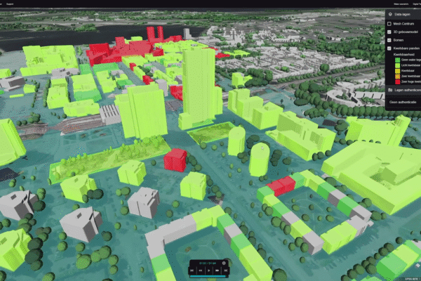
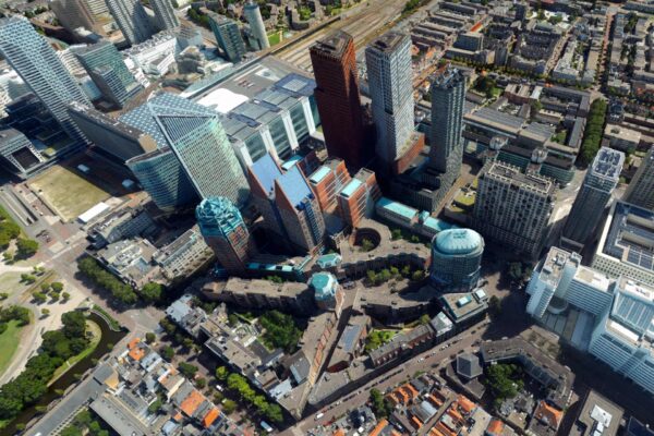
Given the technological capabilities we utilize for our 3D solution (Luciad), we were approached to contribute to the “Totaal 3 Dimensionaal” innovation program. The Totaal 3 Dimensionaal program (hereinafter T3D) was established on behalf of the Association of Netherlands Municipalities (VNG) and the municipalities of The Hague, Rotterdam, and Amsterdam. Its goal is to achieve a breakthrough in the collection, registration, and use of three-dimensional object information, as well as to incorporate all this information into government registries.
This information is then used to address the tasks and (societal) challenges facing public authorities. Municipalities, in particular, have a special interest in this. T3D also contributes to the further elaboration of the municipal perspective on the ongoing development of current basic geographic registries and the implementation of the Integrated Object Registry (SOR).
BIM for T3D
Within the T3D program, the Municipality of The Hague is responsible for the data collection phase. They enlisted our help to make a specific contribution to solving a complex problem. The challenge for The Hague was to find a structural solution for digitally extracting available information from BIM files—which are commonly used in the private sector—and other 3D data. This would support (at least) the processes of permit issuance and the management of basic registries. A key principle here is automation and one-time data collection and registration.
Converting BIM models into IFC files is a complex and time-consuming process. These data files contain a vast amount of detailed information and are therefore often large in file size. Our powerful Luciad simplifies this process and reduces the conversion time. You can now simply drag and drop your BIM models directly into your 3D environment, and the object is digital twin in the digital twin completely automatically.
Quickly load BIM models with and without georeferencing
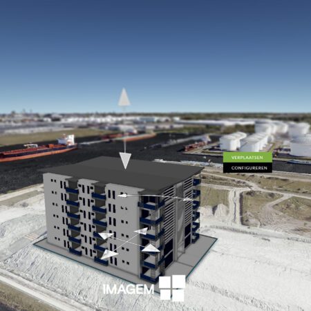
Another common issue is BIM models that aren’t linked to a georeference. We’ve come up with a solution for that as well. When uploading a BIM model without a georeference, you can place the 3D model directly in the correct location by clicking on the map. You can always move the object within the 3D model later on, if needed.
BIM models that do have a georeference are, of course, immediately visualized at the correct location.
The results have been so well received that the VNG has decided to make them publicly available on its knowledge portal so that municipalities can see for themselves how this works.
The solutions proposed by T3D comply with the information management principles of the Common Ground architecture vision and the Gemma Data Landscape.
So starting now, you can easily combine a BIM model with all your other geodata using our BIM converter in Planspace Simulator!
More information
Niels is the Government Market Manager at IMAGEM. He helps government agencies continuously work smarter and more effectively, and fulfills his role by supporting organizations in solving their challenges. Want to learn more? Send Niels an email or send a message via our contact form.
Niels van de Graaf
Government Market Manager