
June 4, 2021 – Climate change has been a major and recurring topic for years, in the news, in politics, and in the business world. There is frequent discussion at the national and international levels about the costs, causes, and consequences. Think of offshore wind farms, nitrogen reduction measures in transportation, housing, and agriculture, or the more recent court ruling regarding Shell. But what about the local level? How, for example, can a municipality determine what impact climate change and adaptation measures are having on its area?
Problems and consequences
Climate change has consequences in various areas, including smaller administrative units such as municipalities. We previously wrote about the effects of heavy rainfall, specifically that water tends to pool in areas with a high proportion of paved surfaces, leading to waterlogging and flooding. The pressure on municipalities and other public authorities to take additional measures to ensure proper drainage of (rain)water is increasing.
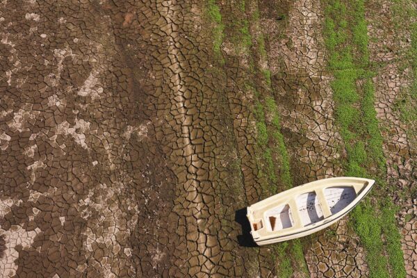
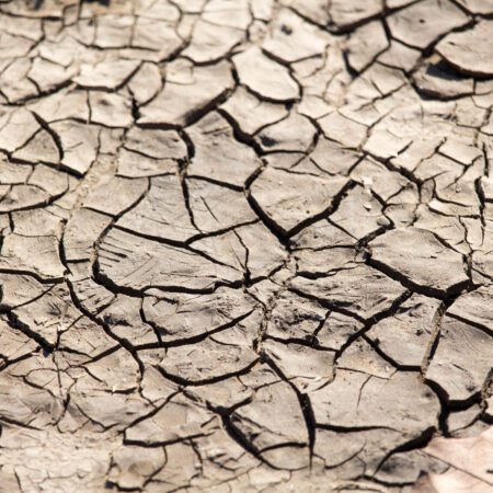
On the other hand, there is drought. We have seen high temperatures in recent summers, but little precipitation, resulting in the soil becoming extremely dry. Periods of precipitation in the Netherlands are becoming shorter and shorter, as all data from the KNMI show. And when it does rain, the rain dries up more quickly. Trees and plants receive less water, fields dry out, which can lead to crop damage or a reduction in water consumption. Peat dikes can dry out, increasing the risk of a dike breach.
Heat stress is also a growing problem. In an increasing number of urban areas, heat lingers for long periods. This can pose a health risk, particularly for older adults and other vulnerable groups. Additionally, in areas with heat islands, for example, asphalt has a shorter lifespan and requires more frequent maintenance.
Stay informed and stay ahead of the curve
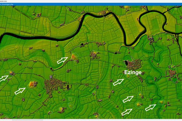
Reversing climate change is a difficult task. Fortunately, however, identifying where climate change could have serious consequences and preparing for them is much easier. It is becoming increasingly tempting to use digital technology to monitor these issues. Satellite imagery is ideal for this purpose, as it provides an overview of your area at a glance. Moreover, such imagery is freely available as open data.
If you know in advance where there is a lot of paved surface, you can take steps to improve drainage in those areas, so that water does not pool or flow into lower-lying areas and cause flooding. Or you can gain insight into the degree of drought in different plots, to see which plots need more attention or where vegetation is at risk of dying. The same applies to heat islands. By identifying these areas in a timely manner, measures can be taken, such as introducing additional green spaces or creating wind corridors.
This means you can remotely monitor and measure the impact of climate change in your area. By uploading open data and satellite imagery into the DELTA remote sensing , you can identify—with just a few clicks—the areas that are vulnerable to or already affected by the impacts of climate change. The results are displayed immediately, allowing you to easily assess them to evaluate the effects of climate adaptation policies and adjust them where necessary.
More information
Tjip is a business consultant at IMAGEM. As a consultant, he helps organizations—such as water authorities—find answers and solutions to spatial challenges, where the key lies in the smart application of location intelligence. Want to learn more? Send Tjip an email or message us via our contact form.

Tjip van Dale
Business Consultant