
April 30, 2021 – Whether you’re conducting an inspection using satellite imagery or simply watching videos on YouTube from your couch, machine learning is everywhere. Consider, for example, Google, Facebook, or LinkedIn, whose search functions are powered by various machine learning algorithms. The same applies to Netflix or Spotify, where shows, movies, and music are recommended based on your previous choices. Even on your phone, when using Siri, Google Assistant, or Alexa, for example, Machine Learning is used for speech recognition or search queries.
Many of these features are designed to improve the user experience, but they can also backfire. Facebook shut down an artificial intelligence program after developers discovered that the program had created its own language that even they couldn’t understand. Researchers at the Facebook AI Research Lab (FAIR) discovered that chatbots were deviating from the script and communicating in a new language without human input.
Why is machine learning necessary?
Regardless of the unexpected nature of this example, the potential of machine learning is clearly evident and has already proven itself. Machine learning is now an established phenomenon and has been increasingly used in the geographic domain in recent years. In 2018, Hexagon released new versions that enable Machine Learning and Deep Learning analyses on geographic data. Yet the very first Machine Learning algorithms are already more than sixty years old. You might wonder what makes Machine Learning so important and relevant today? The answer is simply “data.”

In this rapidly changing world, the volume of data is constantly growing. All of this data requires an ever-increasing amount of storage capacity, computing power, and expertise to organize it. The need for machine learning is therefore inevitable. The concept of machine learning involves the use of statistics and mathematical techniques that enable computers to learn without every step having to be explicitly programmed.
Today, machine learning offers a wide range of possibilities in the geospatial domain. This capability is provided by the “Spatial Modeler” in ERDAS or GeoMedia® from HexagonGeospatial division, and we see this reflected in applications used by various users.
These days, almost everyone uses some form of machine learning without even realizing it. This is true in the geospatial world as well.
Everyday tasks made easy
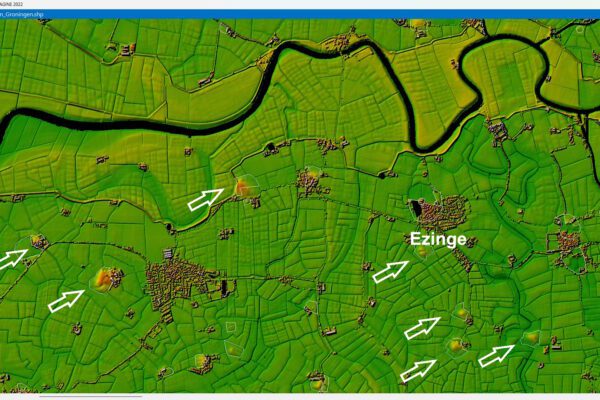
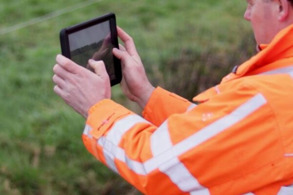
A good example of machine learning applied in our location intelligence solutions is the work we do with water authorities. Like many other government organizations, water authorities are actively working to digitize time-consuming processes. The inspection of waterways, also known as a “waterway survey,” is one such process. This can be partially automated by integrating artificial intelligence into the processing, using satellite imagery.
Machine learning techniques are used to classify waterways in satellite images for automated assessment. The integration of algorithms into analytical models makes it possible to automatically detect anomalies in waterways without the need for on-site inspections. And this is just one example of the many possibilities offered by machine learning.
This technology has been developed into the Schouw M.App solution, a management system used by various water authorities in their inspection processes. Among others, the Drents Overijsselse Delta Water Authority uses this solution to conduct inspections remotely from their offices. Inspections are carried out in a much more targeted manner, resulting in a more efficient use of manpower, time, and money.

The Importance of Data
Data is the key to effective and accurate implementation. A key prerequisite for this is that the data entered is correct. If the baseline data used in analyses is incorrect, the results will also be inaccurate. More than ever, it is therefore crucial that source data is “ABC”: up-to-date, reliable, and complete. If the data is incorrect within a specific management area (such as the location of waterways in a water district), this can result in a significant error rate.
That is why such errors must first be corrected. Using a number of specific models within our DELTA data change detection solution, discrepancies can be automatically detected and flagged for an administrator. By performing these analyses automatically across an entire area, an administrator knows exactly where the discrepancies are and can work specifically on correcting and updating them. This technique can also be applied to detect changes in various basic and core registries.
The next step
Although these examples are already being used within various organizations, we are still in the early stages of exploring these exciting possibilities. The technology is still in its infancy within the geospatial field, but it will continue to evolve and improve, as the possibilities are endless. At IMAGEM , too, developments IMAGEM in full swing, and there are exciting technologies available for use.
More information
Harald is a Business Consultant at IMAGEM. He bridges the gap between business, sales, and technology, and focuses on delivering value to the client. He collaborates with developers to create solutions for the public safety and security sector, educational institutions, and digital twins.
Would you like to learn more about this topic? Send Harald an email or send a message via our contact form.

Harald Görtz
Business Consultant