
How Historical Aerial Photos and Elevation Data Reveal Urk’s Past
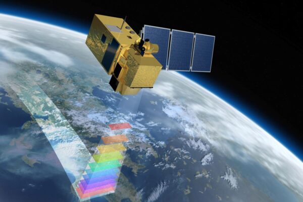
What does today’s landscape reveal about the past? And how can you use that knowledge when making plans for the future? Urk demonstrates what you can discover when you combine historical aerial photographs, current imagery, and elevation data. remote sensing —the remote collection and analysis of data about the Earth—makes old island boundaries, vanished shipways, and other historical traces visible once again. In this sixth episode, Harald demonstrates how this data can help us better understand the landscape and how a “ Digital Twin ” helps incorporate cultural history into future land-use planning.
From an island in the Zuiderzee to a village in the Noordoostpolder
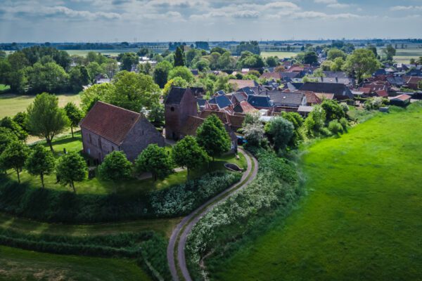
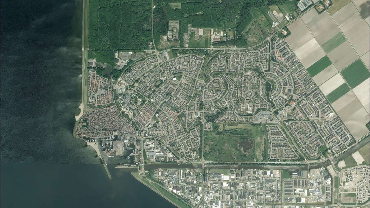
Anyone looking at an aerial photo of Urk today will see a village that is completely integrated into the Noordoostpolder. Residential neighborhoods, roads, industrial parks, and farmland blend seamlessly together. Little remains of the former island. Yet the old Urk is still recognizable—not only in the historic village center and the harbor, but also in the variations in elevation and the structures of the landscape. By combining historical aerial photos, current imagery, and elevation data, we can discover where the island once lay, identify the traces that remain, and bring its history back into view.
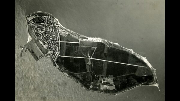
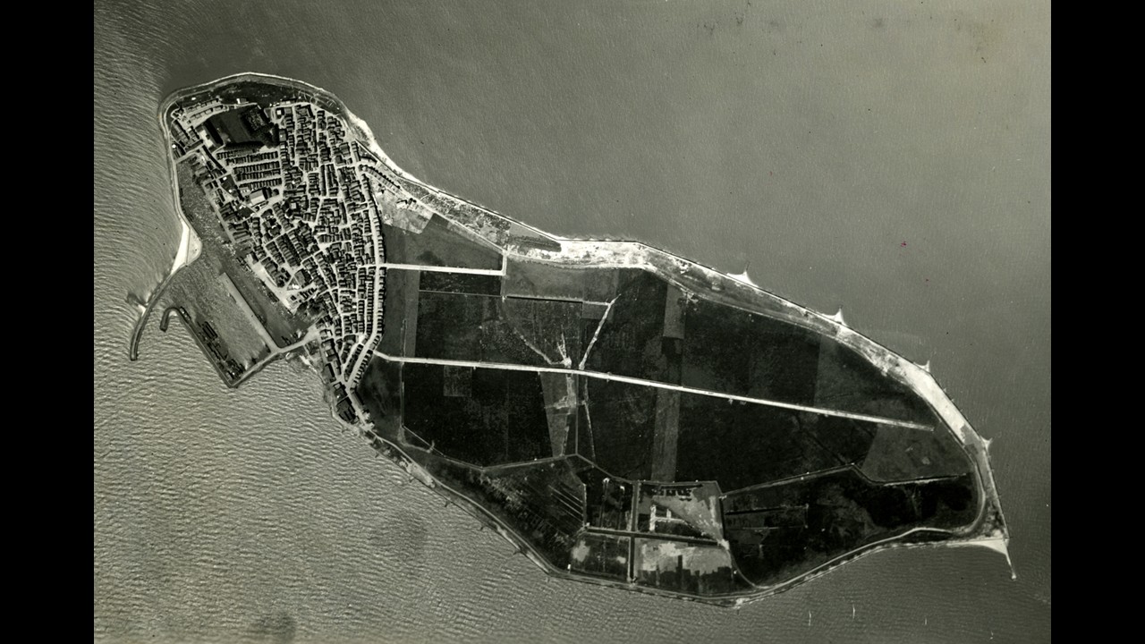
We’ll start with a historical aerial photograph from the period 1935–1939. At that time, Urk was still an island in the Zuiderzee. The buildings were concentrated on the western side, while a large part of the island consisted of open terrain. The roads, the harbor, and the layout of the old village are clearly visible from the air.
If we compare this photo with a recent aerial photo, we can see just how much Urk has changed. The village has expanded far beyond the island’s original boundaries. Yet the shape of the former island remains recognizable.
Geographically Combining Historical and Current Aerial Photographs
The real added value comes when we geographically align the historical and current images. Using orthorectification*, we correct the historical aerial photograph for distortions and overlay it at its correct geographic position onto the current aerial photograph. In this way, the old island literally regains its place in today’s landscape.
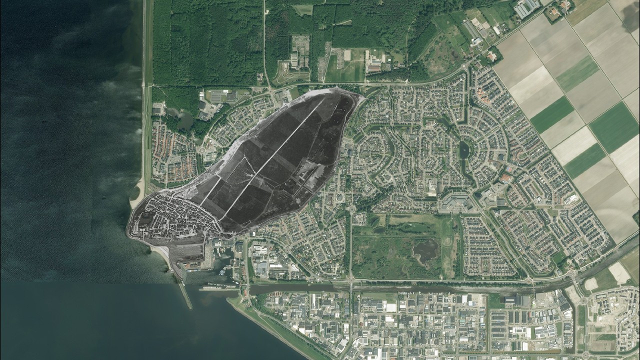
You can see which parts of Urk already existed in the past, where the original buildings stood, and where the island ended. The historical aerial photo is thus no longer just an image from the past, but a layer of geographic information that allows you to directly compare the past with the present. And that yields new insights. Because Urk’s history isn’t just visible in old photos; the elevation of the current landscape tells the same story.
Elevation data reveals the contours of the ancient island
With the Current Elevation Database for the Netherlands (AHN), we are adding another source of information. The AHN contains detailed elevation data for the Dutch landscape.
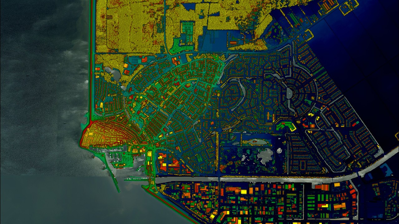
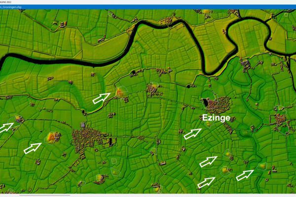
On the topographic map, we can clearly see that the former island is higher than the surrounding polder. Although Urk is now part of the mainland, the original topography is still visible.
When we superimpose the historical aerial photograph transparently over the current topographic map, the connection becomes even clearer. The contours of the ancient island of Urk correspond to the elevation you can now see on the topographic map.
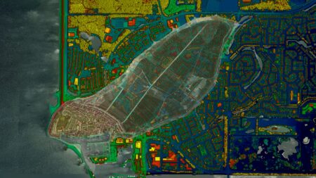
Two different data sources from different time periods thus confirm the same picture. That is perhaps one of the best things about geoinformation:
- The historical aerial photo shows what Urk used to look like.
- The current aerial photo shows how the village has developed.
- And an elevation map shows which physical traces of the past still remain.
When you combine this information, data becomes more than just pixels, lines, or elevations. It becomes a way to understand the landscape.
Revealing old shipways using remote sensing
We’ll take a closer look at the shipyards of Urk. Shipways played an important role in the village’s maritime history. Ships were pulled from the water onto land via these slipways for maintenance and repair.
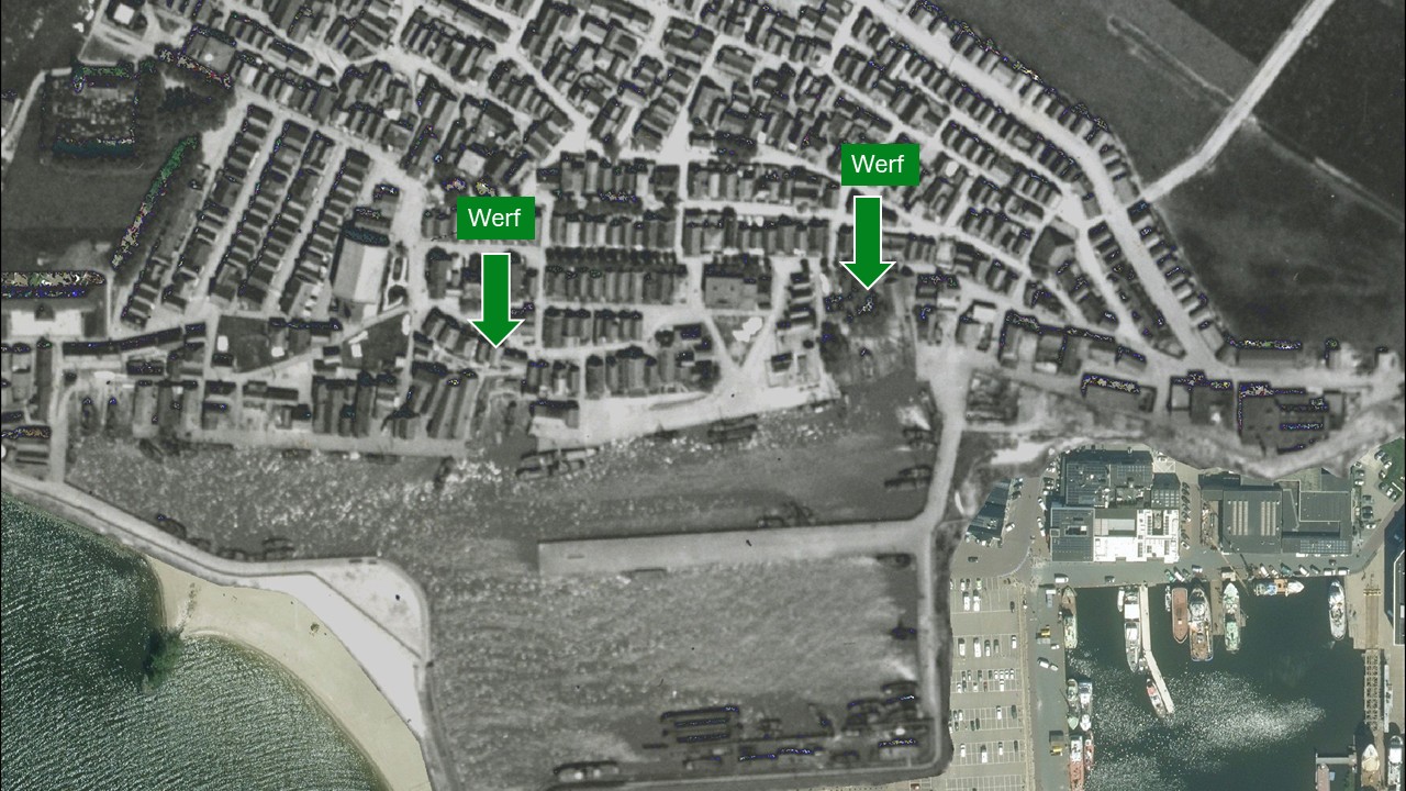
In the historical aerial photograph, we can see two shipbuilding slipways. When we compare these locations with current elevation data, we see that the two sites have developed very differently.
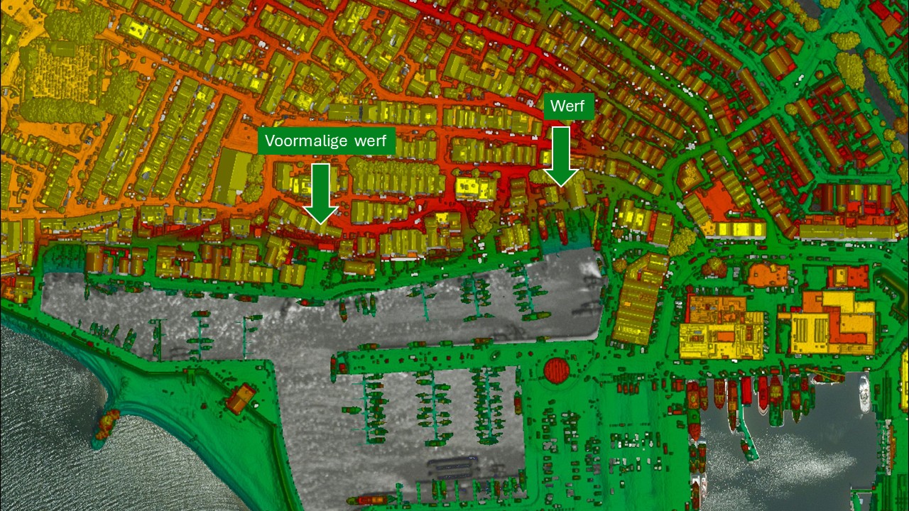
The shipyard on the left no longer exists. On the elevation map, we see mostly flat terrain at this location. At the ship slipway on the right, however, the situation is quite different. The slipway is still recognizable, and there are even two distinct ship silhouettes visible. The data therefore clearly shows that this shipyard is still in use.
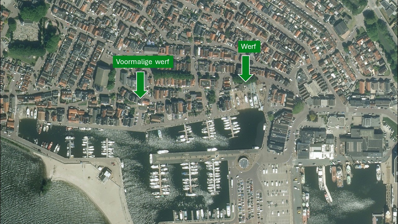
The current aerial photo confirms what we already saw in the elevation data. The shipyard on the right still exists and is in use, while the shipbuilding slipway on the left has disappeared from the landscape. This example shows how remote sensing can be used not only to investigate major changes in the landscape, but also to identify local historical structures and track their development.
A vanished shipyard, a name that lives on
But just because it’s gone doesn’t automatically mean the story has disappeared as well. We’ll zoom in further on the spot where the left ship ramp used to be and take a look at the location of the vanished left ship ramp.
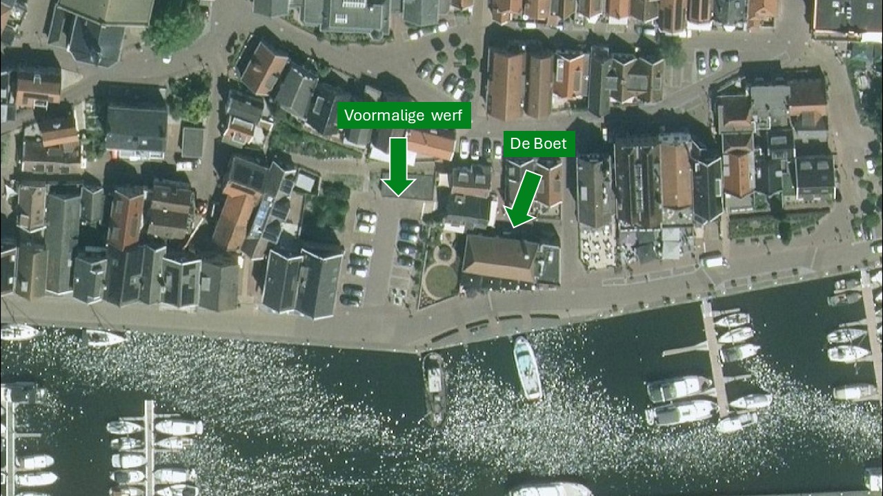
Where ships used to be pulled out of the water, there is now a parking lot. Right next to it is the restaurant De Boet. That name serves as a nice link between today’s Urk and its maritime past. In Urk, a “boet” refers to a shed, a boathouse, or an old fisherman’s cottage. The old shipyard is gone and the area has taken on a new purpose, but a piece of its history lives on in the name.
That makes this location interesting from a cultural-historical perspective. Historical significance isn’t limited to preserved monuments. Sometimes you can find the past in a building, in the landscape, in changes in elevation, or in old sculptures. And sometimes it’s simply in a name.
From separate data sources to a single one Digital Twin
So far, we’ve compared historical aerial photos, current imagery, and elevation data. But what if we brought all this information together in a single digital environment? That’s where Digital Twin adds value. A Digital Twin is a digital representation of the physical environment in which you can bring together, visualize, share, and analyze various types of geographic information. Think of terrain models, point clouds, 3D models, aerial photos, and traditional 2D maps. Instead of consulting separate maps and data files, you work from a single, coherent view of an area. For Urk, this means you no longer have to look at a historical aerial photo, a topographic map, and a current aerial photo separately. You can merge these different layers of information into a single digital view of the environment. To me, that’s a huge added value.
A “ Digital Twin ” not only shows what Urk looks like today, but also how the landscape has evolved over the years. The added value lies not only in the visualization. By combining data within their geographic context, connections emerge that are less likely to be noticed when examining individual data sources. And that is precisely what makes this approach relevant for future area development.
Incorporating Cultural History into Area Development
Area development brings together many different interests and sources of information. Municipalities make decisions regarding housing, infrastructure, public spaces, and landscape design. The cultural and historical value of an area also plays a role in these decisions. A “ Digital Twin ” helps to bring these different perspectives together. In addition to the current situation and future plans, historical information is also included.
Take, for example, an area in Urk that is being redeveloped. Instead of consulting historical aerial photographs solely as archival material, we incorporate them as a geographic information layer into the digital environment where we also review the new plans. In this way, the old island boundary, former buildings, harbor structures, and long-gone shipways become part of the information on which we base our decisions. When evaluating a new design, we then look not only at what we want to achieve at a location, but also at the history of that place.
- What used to be here?
- Which historical structures still exist?
- What is the cultural and historical significance of this site?
- How do we incorporate that meaning into the new design?
That does not mean that every historic structure must be preserved or restored. It does mean, however, that this information is available when we make decisions about the future of an area. In this way, a “ Digital Twin ” helps ensure that cultural history is not merely considered after the fact, but is integrated into area development and urban renewal from the very beginning.
Geodata as the Digital Memory of Our Living Environment
The history of Urk shows just how much information is hidden in our landscape. An island that hasn’t been an island for decades, yet whose contours are still visible. A long-vanished shipyard ramp that we can trace using historical aerial photographs. An existing shipyard that remains recognizable in current elevation data. And a name like De Boet that references its maritime past. Using remote sensing and geodata, we’re bringing these stories back to life. To me, this is where all this data truly shows its power.
- Historical aerial photos allow us to look back.
- With up-to-date image data, we can see what has changed.
- Using elevation data, we uncover traces that have been left behind in the current landscape.
- And with a “ Digital Twin ,” we can bring these different sources of information together and use them to think about the future.
Technically speaking, it’s all about combining data sources. But ultimately, it’s about something much more human: understanding where we’ve come from before we decide where we’re going. In a previous article, I once quoted Helmut Kohl:
If you don't know the past, you can't understand the present or shape the future.
— Helmut Kohl, Chancellor of Germany
I think Urk is a wonderful example of this. By combining historical and current data, a digital memory of the landscape is created—a memory that is valuable not only for looking back, but also for looking ahead.
That is also where the strength of IMAGEM’s expertise lies: linking geographic data, remote sensing , and Digital Twins to concrete issues in the physical environment. This enables organizations not only to better understand what exists and what existed, but also to apply that knowledge when shaping the environment of tomorrow.
*Orthorectification
An old aerial photo is often a little crooked, as if you were looking down at an angle. During orthorectification, we straighten the photo and make it fit properly. We use recognizable landmarks, such as roads, churches, and buildings. This ensures that these locations line up exactly with their positions on the current map. That way, you can easily compare what an area looked like in the past and what it looks like now.
More information
Harald is a Business Consultant at IMAGEM. He bridges the gap between business, sales, and technology, and focuses on delivering value to the client. He collaborates with developers to create solutions for the public safety and security sector, educational institutions, and digital twins.
Would you like to learn more about this topic? Send Harald an email or send a message via our contact form.

Harald Görtz
Business Consultant