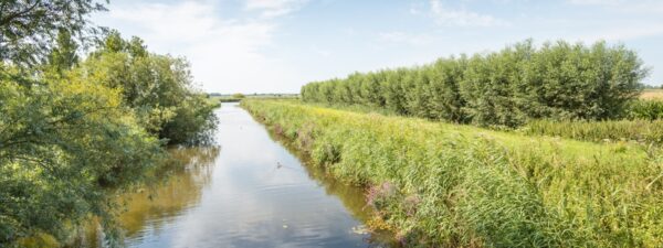

Do you ever bike, walk, or run through the Krimpenerwaard? If so, you know just how wet this area is. Ditches and canals crisscross the landscape, and during the growing season, reeds and aquatic plants bloom in abundance. It’s a beautiful sight, but this vegetation can cause problems in the winter. Waterways play a crucial role in our water management.
Rainfall must ultimately be drained to the sea via canals and rivers. If ditches become too overgrown, this drainage is blocked, creating a risk of flooding. Water authorities are therefore responsible for ensuring that landowners keep these waterways sufficiently clear.
A massive challenge for water authorities
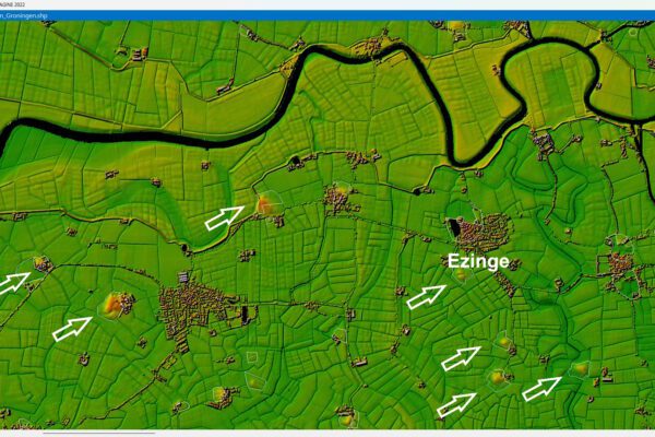
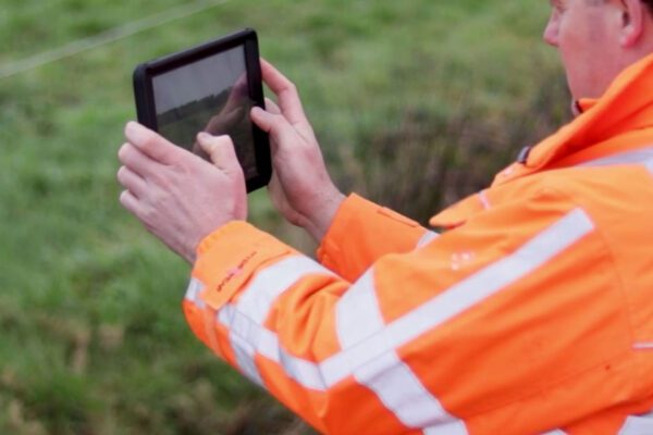
The scale of this task is enormous. A water board can easily manage thousands of kilometers of waterways, all of which must be regularly inspected and maintained. Hundreds of inspectors, or surveyors, go out into the field every year to inspect these waterways. But there is an inefficiency here: many ditches turn out to be in good condition upon inspection. How can surveyors better focus on the problem cases?
Experience shows that in open areas, as many as 80 percent of waterways no longer require physical inspection.
Smart Chimney Inspections Using Satellite Images and AI
This is where technology comes into play. Instead of physically inspecting all waterways, we can use satellite imagery and artificial intelligence (AI). Every few days, a satellite takes a detailed photo of the Netherlands. Thanks to smart algorithms, these images can be analyzed to detect overgrowth in waterways. An AI model is trained to distinguish between clear and overgrown water. This is done by providing the computer with examples of both situations. Once the model has learned enough, it can ‘scroll’ through thousands of kilometers of waterways at lightning speed and with consistent accuracy, predicting where overgrowth will occur.
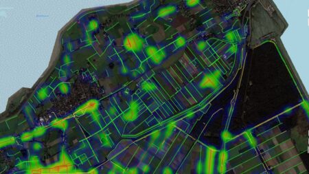
From data to action
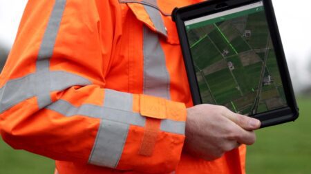
The results of this analysis are then visualized on a map, which inspectors can easily access via their mobile phones. Instead of heading out into the field at random, they can focus directly on the areas where the risk of pollution is highest. We call this process risk-based inspection.
The Benefits of Risk-Based Inspections
- Water authorities save time and resources because they operate more efficiently and only conduct inspections where necessary; in open areas, this can result in savings of up to 80%.
- Inspectors work more efficiently because they can focus their efforts and apply their expertise where it really matters.
- A more sustainable process, as fewer unnecessary checks are conducted and resources are used more efficiently.
Schouw M.app: Digital enforcement for water authorities
With Schouw M.App, developed by IMAGEM, we make the inspection process more efficient and effective. By combining AI and satellite imagery, water authorities can easily and accurately determine which waterways require attention. Experience shows that in open areas, as many as 80 percent of waterways no longer need to be physically inspected. This saves time and money and ensures that enforcement officers can focus on the areas where their efforts are most needed.
More information
Tjip is a business consultant at IMAGEM. As a consultant, he helps organizations—such as water authorities—find answers and solutions to spatial challenges, where the key lies in the smart application of location intelligence. Want to learn more? Send Tjip an email or message us via our contact form.

Tjip van Dale
Business Consultant