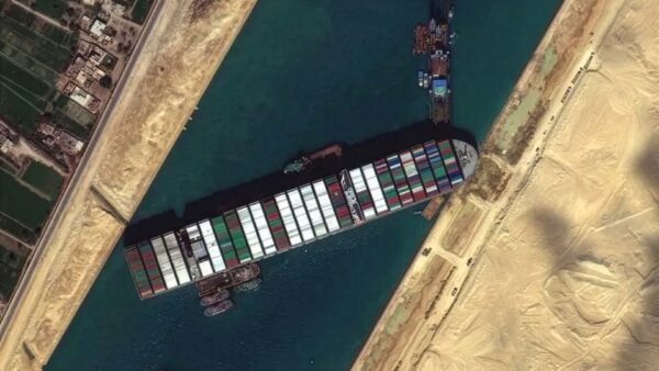

Apeldoorn, March 29, 2021 – The Ever Given, 400 meters long and 60 meters wide, is stuck across the Suez Canal. Getting it back on course is a challenge, but it will be done. Getting shipping traffic in the Suez Canal back up and running is an even bigger challenge!
Blockade in the Suez Canal
On average, 50 ships pass through the 193-kilometer-long canal each day, traveling in three convoys: two from the south and one from the north. Currently, more than 300 ships in total are waiting to use the Suez Canal. Not only is the cargo on these ships delayed, but there is also cargo waiting in the ports that cannot be transported at this time. This is truly a massive logistical challenge.
Using AIS data (Automatic Identification System, or AIS for short, a system based on transponder technology that tracks ships), we can see which ships are located where. However, not all ships are required to have an AIS; this requirement applies to ships of 300 tons or more on international waterways (and all passenger ships).
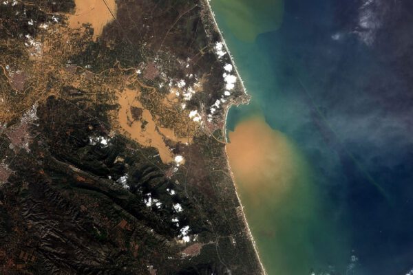
Using satellite imagery, we can gain insight into data such as the total number of ships, their current conditions, their surroundings, what is happening, how the situation is changing, and so on, for this vast area. By using ERDAS , we can process this data into meaningful information.
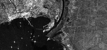
Radar images from satellites such as Sentinel-1, which use synthetic aperture radar (SAR), provide a kind of “X-ray” view of the area.
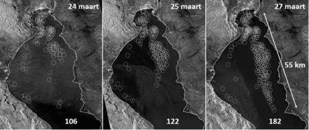
Above is the radar image from March 24 near Suez; the bright white “dots” are ships. Sentinel-1 images are available for the following dates: March 18, 24, 25, and 27. These images provide insight into the location and nature of the activity.
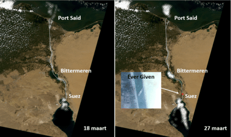
Landsat 8 images from March 18 are also available, which can tell us something about the conditions. This satellite provides a current optical image of the Suez Canal. Incidentally, one Landsat 8 image covers an area of 185 km x 180 km; two were needed to capture the area around the Suez Canal. By then superimposing the radar data from March 18 and March 27 side by side on the Landsat 8 image, we immediately see a massive change.
Not a single ship is sailing through the Suez Canal; all are waiting at Port Said, the Bitter Lakes, and Suez.
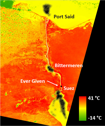
Thermal imaging
Landsat 8 is equipped with various sensors, including TIRS (Thermal Infrared Sensor). This sensor has a resolution of 100×100 meters; however, these TIRS thermal bands are resampled to 30 meters to match the multispectral bands.
ERDAS IMAGINE® can display this data in degrees Celsius. On the right, we see the image from March 18 combined with the radar image from March 27. Water temperatures are around 18 degrees, while on land temperatures even reach a maximum of 41 degrees. The negative values, incidentally, are caused by clouds, which appear as green patches in the image.
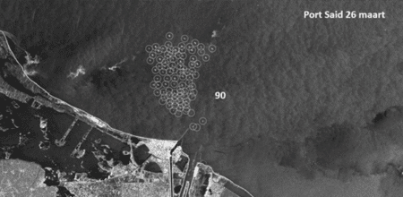
It’s certainly a challenge: live cargo and refrigerated goods sitting idle in a hot climate. Who will be the first to pass through the Suez Canal as soon as it reopens? By analyzing radar images and using SAR Feature Extraction, the ships can be easily counted. A few key figures for Port Said: as of March 26, there are already 90 ships there.
As a result, the Bittermeren have also turned into a “parking lot” for about 40 ships.
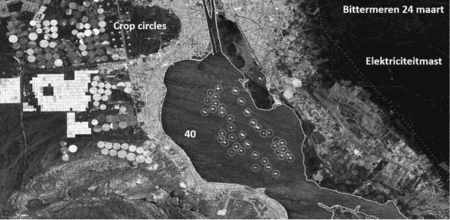
Radar detects more than just metal; it captures the reflection of the energy it emits. The circles on the left side of the image are irrigated farm fields. The varying intensities indicate whether or not there are crops present. On the right side of the image, we can see high-voltage power lines as a distinct dotted line.
The bottleneck is on the southern side of the Suez Canal, where the Ever Given is located and where most of the shipping traffic originates. Following the grounding on March 23, footage shows that within a few days, a 55-kilometer-long “traffic jam” had formed at the entrance to the Suez Canal.
Need a quick solution?
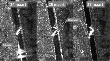
And the Ever Given? Work is in full swing there; as of this writing, the stern has been freed. The radar images clearly show that the ships made room for the salvage vessels on March 24. On March 25, the tugboats arrived, and on March 27, we can see how space is being cleared around the stern.
It will be quite some time before all the logistical challenges are resolved and traffic can once again pass through the Suez Canal without delays. Using satellite imagery and remote sensing, we can monitor the situation.
Update March 29, 3:18 p.m.: The ship has since been refloated, and traffic is moving again.
More information
Harald is a Business Consultant at IMAGEM. He bridges the gap between business, sales, and technology, and focuses on delivering value to the client. He collaborates with developers to create solutions for the public safety and security sector, educational institutions, and digital twins.
Would you like to learn more about this topic? Send Harald an email or send a message via our contact form.

Harald Görtz
Business Consultant