Do you want to monitor changes in the landscape, manage urban green spaces, track climate trends, or streamline your oversight and enforcement processes, but aren’t sure where to start or what data you need? IMAGEM guides you step by step: from selecting the right data types to analyzing and translating data into actionable insights. No technical hassle, just clarity and a clear overview. This allows you to make better-informed decisions, save time and money, and respond more quickly to what’s actually happening out there.
Get a handle on the outside world
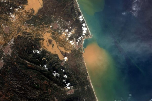
Remote sensing is not an end in itself, but a powerful tool for gaining insight into what is happening in the outside world. It involves collecting sensor data, modeling spatial patterns, and visualizing the impact on the environment. By enriching data with spatial context, we create a powerful tool for analysis and decision-making. We ensure that this technology is practical to use, from data collection to visualization in a dashboard. This provides you with up-to-date and reliable insights as a basis for well-informed decisions.
Why remote sensing is important
Remote sensing is not a replacement for traditional inspections, but a smart complement to them. It enables municipalities, water authorities, and provinces to map large areas with relatively little effort, without having to be physically present everywhere:
- Work more efficiently: less fieldwork, faster decision-making
- Save costs: early detection prevents costly corrective measures
- Smarter planning: up-to-date data supports urban planning and climate adaptation
- Safer management: risks such as dike subsidence or illegal construction are identified more quickly
What can remote sensing do for you?
Remote sensing allows organizations valuable insights at the regional and local levels. It offers quick and accurate insights into what is happening in your local environment without the need to physically visit the area. In addition to custom solutions, there are numerous off-the-shelf applications that allow you to immediately use up-to-date information for monitoring, analysis, and policy-making. Examples include:
For municipalities and environmental agencies
Enforcement in Public Spaces
Identify unauthorized outbuildings or additions using aerial photos and AI.
Landscape Management
Monitor tree health using drones and satellite imagery, and plan targeted maintenance.
Road Safety
Analyze traffic flows using thermal imaging and optimize infrastructure.
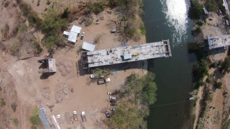
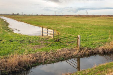
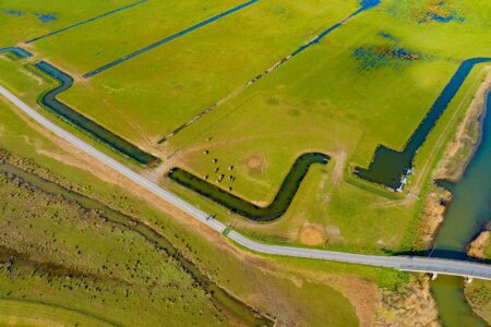
For water authorities
Dike Inspection
Detect track subsidence using hyperspectral cameras and radar imagery.
Water Quality
Measure pollution in real time using sensors in ditches and rivers.
Water Level Management
Monitor land subsidence using satellite imagery and prevent damage.
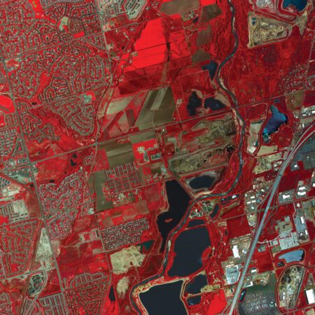
The Power of remote sensing Practice
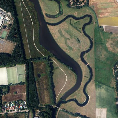
With remote sensing you can identify changes in the environment and support management, monitoring, and oversight activities. Satellite and aerial data offer various options for this purpose.
Frequently Asked Questions
-
Remote sensing is the collection of information about an area without physical contact, typically using satellites, drones, aircraft, or sensors. Unlike fieldwork, remote sensing provides remote sensing , large-scale, and often up-to-date data, which is essential for monitoring and decision-making.
-
There are various types of sensors, each with its own unique applications:
- Optical (RGB, multispectral, hyperspectral): for visual and vegetation analysis
- Thermal: for temperature measurements and energy loss
- Radar (SAR): for cloud penetration and nighttime observation
- LiDAR: for accurate elevation and terrain models
-
Optical images look like regular photos and require sunlight. Radar uses radio waves, which allows you to take images in the dark and through clouds. LiDAR uses lasers, which allows you to collect data in the dark but not through clouds.
-
The timeliness of the data depends on the source. Satellites such as Sentinel provide data every few days, drones can provide real-time data, and LiDAR scans such as AHN are updated periodically. By combining this data with AI and models, IMAGEM enhances the reliability and applicability.
-
This is about how much detail you can see. Some satellites can detect "objects" as small as 0.25 meters, while others mainly detect larger features. We call this ground resolution. In terms of elevation, we can measure with millimeter-level accuracy using SAR and LiDAR.
-
Remote sensing widely used for:
- Urban development (construction, infrastructure, permits), such as tracking construction projects and urban renewal over time in 2D and 3D
- Environmental Management (soil, water, nature monitoring)
- Monitoring & Enforcement (illegal construction, illegal dumping)
- Agriculture (crop monitoring, soil quality)
- Disaster relief, and even security and defense
-
There are various open data sources available:
Learn more about how the data is used.
-
The images are first enhanced, for example by straightening them, removing clouds, or cropping the area you want to analyze. They are then analyzed, and Geo-AI can help identify changes or patterns.
Remote sensing Cheat Sheet
Make the invisible visible. Remote sensing new insights into the Earth by collecting data through advanced sensors, allowing us to see beyond the visible spectrum. Discover the power of remote sensing the limitless possibilities it offers in this cheat sheet.
IMAGEM Remote Sensing
Do you have any questions or would you like to speak with one of our experts? Feel free to call or contact us.

Harald Görtz
Business Consultant
Have questions or want to get started with remote sensing?
With our expertise, experience, and approach, we’re happy to help you use remote sensing address complex challenges or improve your workflows. Ready to get started? Give us a call or fill out our contact form.