News
Filter options
Use the buttons to filter the list of results. The list is updated automatically.


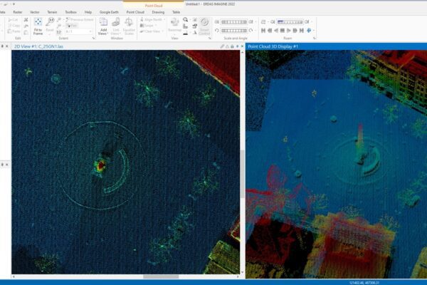
The magic of a cloud of dots
Magical? Absolutely! With a point cloud, we can help you experience the past. We can accurately map the present. They even let you glimpse into the future. In this blog, I’ll take you on a journey into the magical world of point clouds captured using LiDAR. Just a quick technical note...

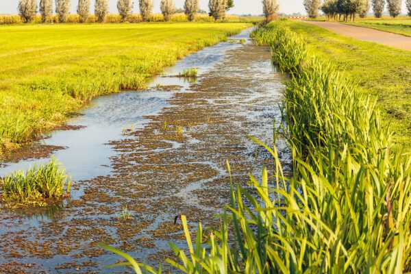
Chimney sweeping in the 21st century
The updated inspection process begins with a digital or satellite inspection. Satellite images of the water board’s area are analyzed using artificial intelligence. A smart algorithm is then used to assess whether the ditches that play a role in drainage have been “properly” or “improperly” cleaned.
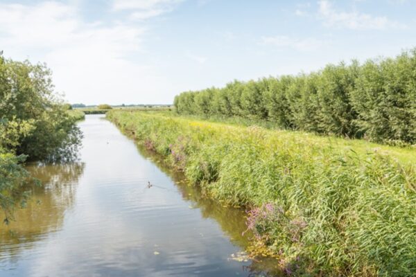

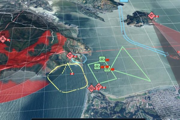
IMAGEM the Department of Defense Extend and Intensify Their Collaboration
Apeldoorn, January 7, 2022 – IMAGEM the Ministry of Defense have extended their partnership by three years. IMAGEM one of the Dutch Defense Organization’s key suppliers of geospatial technology for many years and will continue to serve in this capacity in the coming years. The current partnership is not only being extended but also significantly expanded. This confirms...
Geo and BIM: Working Together Toward digital twins
Geo, BIM, and digital twin. Old and new terms, sometimes just marketing buzzwords or even hype. What is the relationship between them, and where do they overlap? It’s time to take a closer look with John Joosten and Freek Boersma of GeoBIMexperts. Together with IMAGEM , they IMAGEM currently IMAGEM on a project for the Data House, a government agency...

From data-driven to context-aware
When you consider how complex the world around us is, it’s truly remarkable how well people are able to understand problems and turn them into solutions. But does that also apply to our systems? Systems primarily rely on predefined rules. But when it comes to things that don’t fit neatly into a box,...
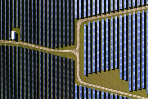
Promoting sustainability by harnessing the potential of solar panels
September 30, 2021 – Climate change is having a major impact on our environment. Rainstorms are becoming more frequent and more intense. We are experiencing hotter summers with longer periods of drought. Sustainable energy management is essential to limiting the effects of climate change. As a result, an increasing number of governments are aiming to become climate-neutral in the future. The municipality of Capelle aan...
Artificial Intelligence: More Than Just Running an Algorithm
September 16, 2021 – “In fifteen years, at least half of our current staff will have retired.” That’s what innovation consultant Jeroen Waanders said three years ago when we asked him what motivated him to explore innovation for his water authority. “If we want to keep doing everything we’re doing now, we simply won’t be able to keep up...”
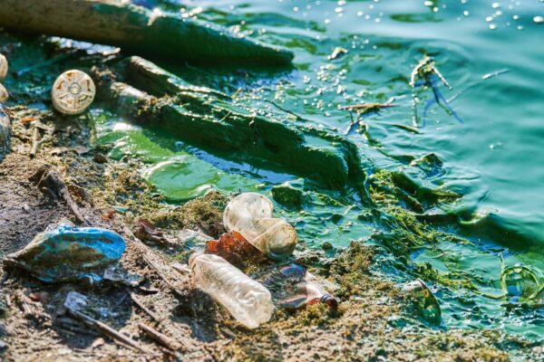
Plastic pollution: we're missing 950 million elephants!
August 26, 2021 – Over the course of 70 years, plastic has gone from a global innovation to a global problem. A problem as big as 950 million elephants! How did this happen? Plastic production took off in the 1950s, and since then we have manufactured approximately 8.3 billion tons of plastic. More than 6.3 billion tons of that is...